HIKING THE BAY CIRCUIT TRAIL
Welcome to the Newenglandwaterfalls.com guide to hiking the Bay Circuit Trail of Massachusetts!
Follow New England Waterfalls on Facebook! 
OVERVIEW
The Bay Circuit Trail ("BCT") of Massachusetts is a 230-plus mile trail that forms a large "C"-shaped arc around the outlying suburbs of Boston from Plum Island in Newbury to Kingston Bay in Duxbury. The trail is a testament to what's possible when dozens of governmental and non-profit agencies work together for a common good.
The BCT is likely different from any other long-distance hikes you've done before. It's less about the views and iconic destinations, and more about quiet conservation areas, local history, and appealing suburban neighborhoods. There are some lovely views and interesting destinations along the way too, of course.
This page was crafted to help spread awareness of the BCT and to help those make the most of their journey. Only a few hundred people have completed the entire trail thus far. Unlike the big mountains of New England and their crowded trails, the BCT is still very lightly used. It is so lightly used that it could arguably benefit from a moderate increase in usage and a more broad support.
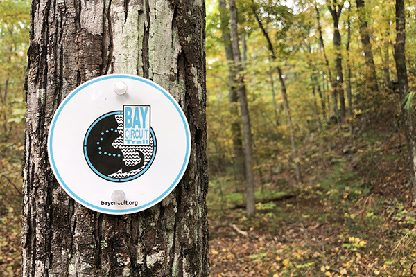
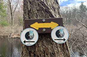
one of the signature Bay Circuit Trail markers/blazes
TOWNS & CITIES ALONG THE WAY
Here is a list of all of the town and cities you'll hike through as you progress along the Bay Circuit Trail. I've also included the map number from the 2015 edition of the AMC's Bay Circuit Trail Map & Guide. Lastly, I've also indicated where the spur trails are located, as well as the last three remaining gaps in the trail.
Take note that this list is described in a northern-to-southern direction.
MAP #1 TOWNS/CITIES
Here are the towns and cities that the trail passes through on map #1 of the AMC's Bay Circuit Trail Map & Guide (2015 edition):
Take note that there are two northern terminus. One is in Newbury (Plum Island) and one is in Hamilton (Appleton Farms). The two trails link up within a well-marked junction in Willowdale State Forest in Ipswich.
Northern Terminus-Northern Spur/Branch
| Newbury |
| Newburyport |
| Newbury |
| Rowley |
| Ipswich |
Northern Terminus-Southern Spur/Branch
| Hamilton |
| Topsfield |
| Ipswich |
MAP #2 TOWNS/CITIES
Here are the towns and cities that the trail passes through on map #2 of the AMC's Bay Circuit Trail Map & Guide (2015 edition):
| Ipswich |
| Topsfield |
| Boxford |
| Rowley |
| Georgetown |
| Boxford |
| North Andover |
| Middleton |
| North Andover |
| Andover |
MAP #3 TOWNS/CITIES
Here are the towns and cities that the trail passes through on map #3 of the AMC's Bay Circuit Trail Map & Guide (2015 edition):
| Andover |
| Tewksbury |
| Lowell |
| Chelmsford |
Trail Gap: Take note that there is a gap in the trail between Lowell & Chelmsford. This is one of the three gaps that still exist on the BCT as of 2021.
MAP #4 TOWNS/CITIES
Here are the towns that the trail passes through on map #4 of the AMC's Bay Circuit Trail Map & Guide (2015 edition):
| Chelmsford |
| Westford |
| Acton |
| Concord |
| Lincoln |
Optional: Eastern Spur/Branch
Take note that there is an optional branch of the trail that runs from Bedford to Concord. It links up with the main trail in Minuteman National Historic Park in Concord.
MAP #5 TOWNS/CITIES
Here are the towns that the trail passes through on map #5 of the AMC's Bay Circuit Trail Map & Guide (2015 edition):
| Concord |
| Lincoln |
| Wayland |
| Sudbury |
| Framingham |
| Marlborough |
| Southborough |
Optional: Eastern Spur/Branch
Take note that there is an optional branch of the trail that runs from Lincoln to Wayland. It links up with the main trail near downtown Wayland.
MAP #6 TOWNS/CITIES
Here are the towns that the trail passes through on map #6 of the AMC's Bay Circuit Trail Map & Guide (2015 edition):
| Framingham |
| Marlborough |
| Southborough |
| Ashland |
| Sherborn |
| Medfield |
MAP #7 TOWNS/CITIES
Here are the towns that the trail passes through on map #7 of the AMC's Bay Circuit Trail Map & Guide (2015 edition):
| Sherborn |
| Medfield |
| Walpole |
| Sharon |
MAP #8 TOWNS/CITIES
Here are the towns that the trail passes through on map #8 of the AMC's Bay Circuit Trail Map & Guide (2015 edition):
| Sharon |
| Easton |
| West Bridgewater |
| Bridgewater |
| East Bridgewater |
Trail Gap: Take note that there is a gap in the trail between Bridgewater & East Bridgewater. This is one of the three gaps that still exist on the BCT as of 2021.
MAP #9 TOWNS/CITIES
Here are the towns that the trail passes through on map #9 of the AMC's Bay Circuit Trail Map & Guide (2015 edition):
| East Bridgewater |
| Hanson |
| Pembroke |
Trail Gap: Take note that there is a gap in the trail within the town of Hanson. This is one of the three gaps that still exist on the BCT as of 2021.
The southern terminus is within the Bay Farm Conservation Area in Duxbury. Take note that there are two different routes to get there from Pembroke. Here is a description of each:
Southern Terminus-Northern Spur/Branch
| Pembroke |
| Duxbury |
| Newbury |
| Rowley |
| Ipswich |
Southern Terminus-Southern Spur/Branch
| Pembroke |
| Kingston |
| Duxbury |
You can see all of the towns and cities along the BCT by referring to the online BCT Interactive Map.

Old Town Hill Reservation, Newbury
GENERAL NOTES & TIPS
Here are some general notes and trips about hiking the Bay Circuit Trail:
- MAPS - I highly recommend buying and carrying the AMC's "Bay Circuit Trail Map & Guide" (2015), even though the map's content is roughly 5% stale/out-of-date as of 2021. I recommend studying the AMC map but then also comparising it to the "interactive map" (tip: use full screen mode) on the www.baycircuit.org website. While looking at both maps, take note of changes that have occurred since the 2015 AMC map was printed/published.
- NAVIGATION - Stay straight on the trail unless you see trail markers that instruct you otherwise. There are many roads that don't have blazes at T-junctions. Always look down the side road to see if you spot a blaze or marker; if you don't, odds are high you'll need to just stay straight.
- TRAIL CONDITIONS - You are encouraged to report trail conditions on the www.baycircuit.org website if you encounter any issues while hiking the Bay Circuit Trail. Please also report if any markers/blazes are needed to prevent others from getting lost or confused. You should also check the Bay Circuit Trail website to understand any current trail impacts/updates (such as areas that may experience spring flooding, e.g. Andover AVIS properties).
- ROAD WALKING - As of December 2020, roughly 60-70% of the trail is hiking in the woods and 30-40% of the trail is road-walking. Take note that roughly about 50% of the road-walking is on streets that do not have sidewalks. Some of these streets are major roads. This can make portions of the trail a bit uncomfortable for parents if they are hiking with young children. Otherwise it's not too big of a deal.
- BLAZING/MARKERS - As of December 2020, about 95% of the trail trail is well-blazed and easy to follow. For the rest of the trail, it is helpful to have a map and/or the printed directions from the Bay Circuit Trail website.
- You can also use the interactive map from the BCT website as you hike along. Most of the trail does provide cell coverage for major carriers. You can also print (or screenshot) directions from the BCT website as well.
- TRAIL GAPS - The BCT is not a completely continuous footpath, but it is close to becoming one. There are still three gaps that remain. Hopefully one day all three gaps will be closed. However, this is likely to be difficult given the private property that sits between the two points.
- PETS - Dogs are prohibited in several of the conservation areas that you pass through, including the wildlife sanctuaries of the Mass Audubon. I would say about 80% of the trail is pet-friendly (on-leash, of course).
- BIKING - We recommend considering bringing a bicycle and hiking between trailheads (instead of bringing two cars). Due to the sometimes erratic winding nature of the trail, there are many sections of the trail that make this easy to do, and with only moderate mileage involved (far less than what you hiked).
- BIKING - You can bicycle a lot of the trail, but there are many places where it is prohibited and/or it is just too rocky or otherwise difficult.
- SCOOTERS - We carried a small (non-electric) scooter so that our 5-year daughter could scooter on the paved sections. She enjoyed the mix of walking on the hiking trails and scootering on the roads and sidewalks.
- CAMPSITES - There are only a very limited number of official campsites directly along the BCT. At this point, the BCT is really intended for day hikers. Here is a list of camping options on or near the trail:
- Harold Parker State Forest
- Camp Acton
- Hanson Town Forest
- Sampson Forest & Memorial Park
- HOTELS - There are only a few hotels and inns that are on or near the BCT. You'll have much better luck finding more if you drive 10-20 minutes away from the trail. You could also try Airbnb as well.
- PONYHENGE - Don't miss Ponyhenge! It's only about 200 feet northeast of the BCT in Lincoln off Old Sudbury Rd near Drumlin Farm. It is perhaps one of the most memorable roadside attractions in New England.
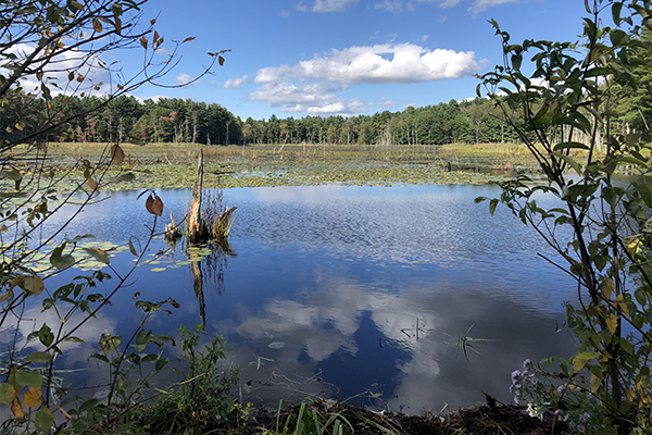
One of the many of ponds you'll pass along the Bay Circuit Trail
TRAILHEADS / PARKING
Here are some general notes about the various trailheads and parking areas of the Bay Circuit Trail:
- In general, you can find an official trailhead or parking area every three or four miles along the BCT.
- It is very rare to go more than five miles without finding one.
- There are many other unofficial parking areas, but you must use your judgement before using any of them.
- Please do not park anywhere that is illegal or anywhere that has the potential to upset any landowners that abut the Bay Circuit Trail.
- All of the trailheads that we saw along the BCT seemed safe to us. None were located in areas that we would consider unsafe.
- Parking is generally free, although a half-dozen or so trailheads do charge a nominal fee (e.g. $5/vehicle).
- Parking can at times be challenging at several of the more popular and/or limited-space trailheads. You should try to arrive early to beat the crowds at the following trailheads:
- Plum Island, Newbury
- Ward Reservation, Andover
- Minuteman National Historic Park, Concord
- Great Meadows National Wildlife Refuge, Concord
- Walden Pond State Reservation, Concord (this park is insanely busy and parking is usually full mid-day)
- Drumlin Farm, Lincoln
- Heard Farm, Wayland
- Tippling Rock, US-20, Sudbury
- Rocky Narrows, Sherborn
- Noon Hill Reservation, Medfield
- Moose Hill Wildlife Sanctuary, Sharon
- Borderland State Park, Easton
- Burrago Pond WMA, Hanson
Do you know of any other places where parking is limited or challenging? If so, please email me at gparsons66@hotmail.com so that we can add to this list.
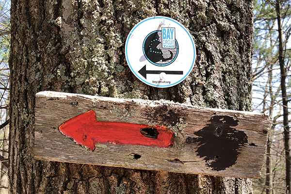
Bay Circuit Trail sign
CONSERVATION AREAS
One of the neatest things about the BCT is how many different and enjoyable conservation areas you pass through along the way. Here is a sample of some of the major conservation areas along the trail. If you are like us, you probably haven't heard of most of them. These areas are listed in order from north to south:
- Joppa Flags Wildlife Refuge, Newbury
- Spencer-Pierce Little Farm, Newbury
- Old Town Hill Reservation, Newbury
- Willowdale State Forest, Ipswich
- Appleton Farms, Hamilton
- Bradley Palmer State Park, Hamilton
- Georgetown Rowley State Forest, Rowley/Georgetown
- Boxford State Forst, Boxford/Middleton
- Harold Parker State Forest, North Andover/Andover
- Ward Reservation, Andover
- Minuteman National Historic Park, Concord
- Great Meadows National Wildlife Refuge, Concord
- Walden Pond State Reservation, Concord
- Mt. Misery Conservation Area, Concord
- Callahan State Park, Framingham/Marlborough
- Ashland Town Forest, Ashland
- Sherborn Town Forest, Sherborn
- Rocky Narrows, Sherborn
- Shattuck Reservation, Medfield
- Noon Hill Reservation, Medfield
- Walpole Town Forest, Walpole
- Moose Hill Wildlife Sanctuary, Sharon
- Borderland State Park, Sharon/Easton
- Wheaton Farm Management Area, Easton
- Hockomock Swamp WMA, Easton/West Bridgewater
- Burrage Pond WMA, Hanson
- Bay Farm Conservation Area, Duxbury/Kingston
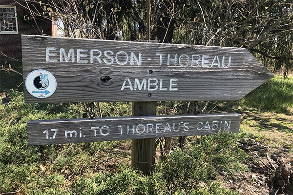
Bay Circuit Trail in Concord
FOOD ALONG THE BAY CIRCUIT TRAIL
Here is a list of some notable eating options on or near the Bay Circuit Trail. My wife and I have either eaten at these places ourselves or we received glowing recommendations from locals (which we then cross-referenced against Yelp & Tripadvisor reviews to confirm). These establishments are listed in order from north to south.
| TOWN |
RESTAURANT |
TYPE |
DISTANCE |
NOTES |
| Rowley |
BRADFORD TAVERN |
American |
on the actual trail |
typically open for lunch & dinner |
| Rowley |
AMERICAN BBQ |
BBQ |
on the actual trail |
typically open for lunch & dinner |
| Rowley |
VILLAGE PANCAKE HOUSE |
Breakfast |
short walk (south) |
|
| Ipswich |
WHITE FARMS ICE CREAM |
Dessert |
short walk (south) |
|
| Ipswich |
CLAM BOX |
Fried seafood |
3-minute drive (southeast) |
some of the best fried clams on the planet |
| Ipswich |
TRUE NORTH ALE CO. |
Brewery |
3-minute drive (north) |
limited food available |
| Ipswich |
ZENO'S ROAST BEEF |
Roast beef |
5-minute drive (north) |
one of the classic North Shore roast beef establishments |
| Ipswich |
CHOATE BRIDGE PUB |
American |
5-minute drive (north) |
|
| Rowley |
AGAWAM DINER |
American |
2-minute drive (west) |
eat in a "nostalgic 1954 rail car diner" |
| Topsfield |
THE WHOO(PIE) WAGON |
Dessert |
3-minute drive (south) |
unique flavors of whoopie pies |
| Andover |
OAK & IRON BREWING CO. |
Brewery |
short walk (north) |
|
| Tewksbury |
TESSI'S ROAST BEEF |
Roast beef |
short walk (southwest) |
one of the classic North Shore roast beef establishments |
| Chelmsford |
HERRADURA VIEJA |
Mexican |
short walk (southeast) |
|
| Wayland |
SPICE & PEPPER |
Thai |
on the actual trail |
|
| Marlborough |
FIREFLY'S BBQ |
BBQ |
10-minute drive (west) |
one of the best BBQ restaurants in Massachusetts |
| Ashland |
STONE'S PUBLIC HOUSE |
Irish-American |
on the actual trail |
|
| Ashland |
MEXICO CITY TAQUERIA |
Mexican |
short walk (southwest) |
|
| Ashland |
DORAGON RAMEN |
Japanese |
short walk (southwest) |
|
| Ashland |
MARATHON DELI |
Sandwiches |
short walk (southwest) |
|
| Ashland |
ASHLAND ALE HOUSE |
American |
on the actual trail |
located in the same plaza as Market Basket |
| Sharon |
CRESCENT RIDGE DAIRY BAR |
Dessert |
5-minute drive (northeast) |
|
| North Easton |
THE FARMER'S DAUGHTER |
Breakfast |
10-minute drive (north) |
American-style breakfast & lunch |
| West Bridgewater |
CRYSTAL'S KITCHEN |
Asian |
short walk (north) |
Thai, Chinese, Japanese & Malaysian specialties |
| West Bridgewater |
BARRETT'S ALE HOUSE |
American |
2-minute drive (northwest) |
small chain |
| Brockton |
CAPE COD CAFE PIZZA |
Pizza |
10-minute drive (north) |
|
| East Bridgewater |
JOHNNY MACARONIS |
Italian |
3-minute drive (southeast) |
love their bread! there are several other nearby locations |
| Pembroke |
DAIRY TWIST |
Dessert |
3-minute drive (north) |
|
| Pembroke |
ALUMNI SPORTS CAFE |
American |
5-minute drive (north) |
|
Did I miss any notable food establishments along the Bay Circuit Trail? Have any of these establishments gone out of business? If so, please email your suggestions and/or updates to gparsons66@hotmail.com so that I can update here.
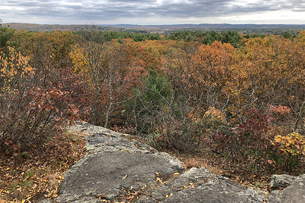
View from Tippling Rock in Sudbury
TRAIL CHALLENGES
The Bay Circuit Trail is a long but fairly easy trail. For those that have hiked in the big mountain ranges of Northern New England or in western Massachusetts, the BCT is unlikely to present any significant challenges.
That being said, there are a few challenges that you should be aware of:
- The Lowell section of the BCT along the Merrimack River is in rough shape. It's overgrown with thorn bushes and there's no clear trail through. Unless you are determined to hike the entire trail right now, I would avoid this section until the AMC does something about it.
- This is by far the worst section of the BCT. I would say it's the only section that we did not enjoy.
- Many of the road-walk sections do not have sidewalks. A few of those sections may be slightly uncomfortable for some due to heavy traffic, although that uncomfortableness will only be for a very short period. Parents with young children may not appreciate these sections.
- Some parking areas can fill up. Try to arrive early if you are parking at one of the popular trailheads.
For those that hiked the BCT a few years ago, take note that improvements have been made in Rowley and North Andover, both of which suffered from overgrown vegetation.
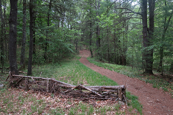
Bradley Palmer State Park
WHAT'S OUT-OF-DATE ON THE 2015 AMC MAP & GUIDE?
The 2015 edition of the AMC's Bay Circuit Trail Map & Guide is still the best printed map of the BCT. However, you should be aware that the map is stale/out-of-date in a few key areas. This includes:
- The trail has been re-routed along the North Andover and Middleton line.
- The trail along the Bruce Freeman Rail Trail has been extended south into Acton. There is no longer a gap of trail here.
- The section of trail from Market Basket in Ashland to Whitney Street in Sherborn is 1.7 miles, not 0.9 miles.
- There's a small re-route in Sherborn; just follow the blazes and you'll be fine.
- There is an entire new eastern spur of the trail from near Donelan's Supermarket in Lincoln to downtown Wayland. This essentially creates a mini-loop of the BCT. This entire section isn't currently shown on the map at all.
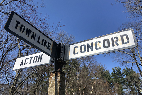
Action / Conford Town Line Sign
BAY CIRCUIT TRAIL IN WINTER
While it is possible to hike the Bay Circuit Trail in winter, it is more challenging. A few may even find some sections to be frustrating. These notes are not meant to scare you away from hiking the BCT in winter; they are merely intended to make you aware that hiking in winter presents its own set of challenges.
Here are some considerations if you are thinking about hiking the BCT in winter:
- Since many of the roadwalks are on streets that do not have sidewalks, these roads are going to be less safe in winter. Additionally, snow banks may force you to walk further into the roadway than you would outside of winter.
- You are likely to find that many sections are not hiked in winter, which means you'll need to "break trail".
- A select few sections of the trail could be fairly difficult to follow if no other hikers have broken trail yet.
- It may be frustrating to have to take your foot traction and/or snowshoes on-and-off multiple times per day since the BCT terrain is constantly changing from trail to road and back to trail again.
- Some of the parking areas are likely to be unplowed in winter.
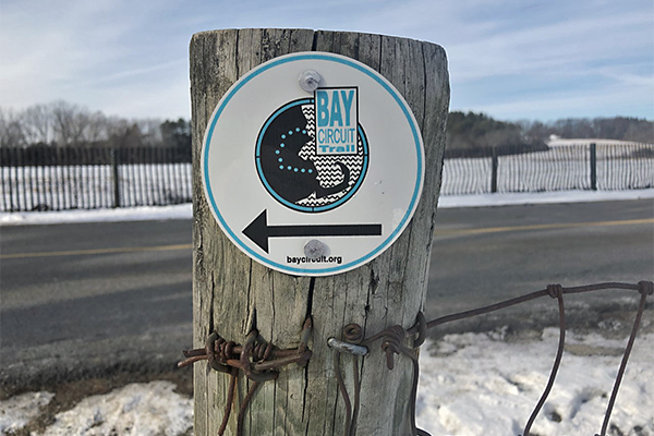
one of the standard BCT trail markers

An interesting entry point to the trail
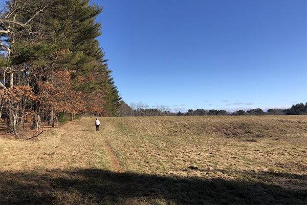
You'll pass through many farms along the way
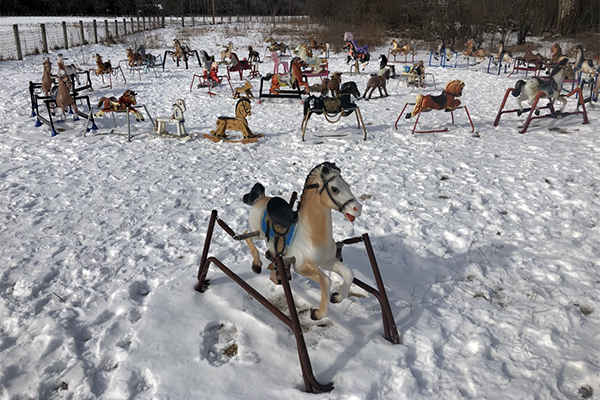
Ponyhenge! A unique roadside attraction just 200 feet off the trail in Lincoln
PACKING LIST
Here is a packing list for day hiking the Bay Circuit Trail:
- FOOD & WATER
- Food and snacks
- Water (my general rule is to bring 1 liter of water for every 3-4 miles of hiking the BCT)
- Electrolytes drink (i.e. Gatorade, Powerade, etc.)
- GEAR
- Hiking shoes, hiking boots, or trail-running shoes
- Backpack
- Trail info/route description printed from the www.baycircuit.org website
- AMC's Bay Circuit Trail Map & Guide (2015 edition)
- Important Note: it is recommended that you compare this map to the online interactive map on the www.baycircuit trail.org website since a few changes have occurred.
- Water bottles and/or water bladder/hydration reservoir
- Trekking poles
- Smartphone
- Camera
- Headlamp and batteries (just in case...)
- CLOTHING
- Shirt-quick drying
- Hiking socks (non-cotton)
- Hiking pants or shorts
- Waterproof jacket
- Underwear-quick drying
- Fleece jacket, softshell jacket, and/or down jacket
- Hat, gloves, and/or neckwarmer when it's cold
- COMFORT & TIOLETRIES
- Tiolet paper (there are very few bathrooms / porta-potties along the trail)
- Hand sanitizer
- Bug spray (although you likely won't need it on most days, it is recommended that you carry this from mid-May until early-August)
- SAFETY & SECURITY
- Face mask (for COVID-19)
- Safety whistle
- First aid
- Identification / wallet / credit card
|

