| STATE |
WATERFALL NAME |
SCENIC
POTENTIAL |
TOWN |
DELORME MAP? |
NOTES & DESCRIPTION |
| ME |
Abol Falls |
unknown |
T2 R9 |
Not Listed |
there are rumors of a waterfall on Abol Stream just south of the Park Tote Road in Baxter State Park; you are likely going to need to BUSHWHACK from Park Tote Road or Abol Beach Road; here is my best guess as to the location: GPS = 45.844630, -68.942574 |
| ME |
Albany Basins |
unknown |
unknown |
Not Listed |
rumored set of waterfalls on Albany Stream; "about 12 miles from Bethel" |
| ME |
Algers Falls |
unknown |
unknown |
Not Listed |
rumored waterfall on Algers Brook; there is a chance this is the same place as "Carters Falls"; no other information known |
| ME |
Allagash Falls |
EXCELLENT |
T15 R11 |
Page 62
A-3 |
access to these falls on the Allagash River is most likely only possible via canoe or kayak; there is a campsite near the falls; the falls are typically reached as part of a Allagash Wilderness Waterway canoe-trip; this is a 40-foot tall wild & scenic falls; there is a very slim chance you may be able to hike or BUSHWHACK to the falls from Michaud Farm Rd (although that road itself may be PRIVATE PROPERTY) |
| ME |
Allens Falls |
unknown |
Windham |
Not Listed |
rumored waterfall on the Pleasant River; no other information known |
| ME |
Ambajejus Falls |
POOR |
T1 R9 |
Page 43
A-1 |
just a set of rapids on the West Branch of the Penobscot River |
| ME |
Ammacongan Falls |
unknown |
unknown |
Not Listed |
this waterfall is mentioned in the (sometimes unreliable) Maine waterfalls guidebook; it could be a DAM or it could have been drowned by one; no other information is known |
| ME |
Ammonscoggin Falls |
POOR |
Westbrook |
Not Listed |
most likely a DAM on the Presumpscot River, although it may have small rapids or cascades below it; access may be possible on Cumberland Street; also known as Cumberland Mills Falls |
| ME |
Andover Falls |
POOR |
Andover |
Not Listed |
rumored waterfall on the Ellis River; this is likely to be a set of rapids or very small cascades; may be visible from North Andover Road / Main Street by looking east while crossing the bridge over the river |
| ME |
Andrews Falls |
unknown |
Windham |
Not Listed |
another rumored waterfall on the Pleasant River; no other information known |
| ME |
Ariscoos Falls |
unknown |
unknown |
Not Listed |
rumored waterfall on the Magalloway River; no other information known |
| ME |
Arnold Falls |
POOR |
Unknown |
Not Listed |
just a set of rapids on the South Branch of the Dead River; "near Stratton" |
| ME |
Aroostook Falls |
POOR |
T7, R9 |
Not Listed |
this book was described in the (sometimes unreliable) Maine Waterfalls guidebook as a DAM, but I can find no information online about it; there's a chance this was drowned when a DAM was built, and there's also a chance this place never existed at all |
| ME |
Attean Falls |
POOR |
Bradstreet |
Page 39
C-5 |
just a set of rapids on the Moose River; I have heard rumors that access requires a long (4-5 miles one-way) canoe or kayak paddle |
| ME |
Auburn Falls |
POOR |
Auburn |
Not Listed |
this is a small stone DAM on Sucker Brook; the falls can be viewed from Hooksett Road or Griffin Mill Road |
| ME |
Augusta Falls |
FAIR |
Augusta |
Not Listed |
this was a DAM on the Kennebec River, but research tells me that the DAM may have been recently removed; if the DAM has in fact been removed, this waterfall could be slightly promising |
| ME |
Ayers Falls |
POOR |
Orono & Bradley |
Not Listed |
just a set of rapids on the Penobscot River; the rapids are likely to be visible from Broadway Street in Orono; there's a chance you may also be able to see the rapids through the trees from ME 178 (Main Street) in Bradley |
| ME |
Aziscohos Falls |
POOR |
Lincoln |
Not Listed |
looks like small cascades below a DAM on Bear Brook; access may be possible by BUSHWHACKING downstream from Wilson Mills Road, although you may run into PRIVATE PROPERTY |
| ME |
Bachelder Falls |
unknown |
unknown |
Not Listed |
no information is known about this particular waterfall |
| ME |
Bacons Falls |
unknown |
Paris |
Not Listed |
rumored waterfall on the Little Androscoggin River; no other information known |
| ME |
Bad Little Falls
(picture)  |
GOOD |
Machias |
Not Listed |
these falls on the Machias River supposedly drop a total of 50 feet; alternative name is Machias Falls; the falls should be viewable from Elm Street/ME 92 within the 'Bad Little Falls Park'; you supposedly can't see the falls from US-1 |
| ME |
Bagaduce Falls |
POOR |
Brooksville |
Page 15
B-3 |
this is a REVERSING/TIDAL FALLS and not a true waterfall; access is likely possible via Bridge Street |
| ME |
Baker Pond Falls |
GOOD |
Caratunk |
Not Listed |
according to the (sometimes unreliable) Maine waterfalls guidebook, this is a 30-40 foot drop reached on 0.2 mile hike; a trailhead is supposedly on Bakers Road (or did the author mean Baker Dimmock Road?) |
| ME |
Bakers Falls (Windham) |
FAIR |
Windham |
Not Listed |
this appears to be a small set of falls on the Pleasant River; you may be able to see the falls through the trees off US 202 (Gray Road) just south of Sturgis Road; there's a very good chance that the falls are located on PRIVATE PROPERTY; GPS = 43.836986, -70.383713 |
| ME |
Bakers Falls (Yarmouth) |
FAIR |
Yarmouth |
Not Listed |
a set of cascades on the Royal River within Royal River Park; "Factory Falls" and "Four Falls" are also located nearby |
| ME |
Bangor Falls |
unknown |
unknown |
Not Listed |
this waterfall is mentioned in the (sometimes unreliable) Maine waterfalls guidebook; it could be a dam or it could have been drowned by one; no other information is known |
| ME |
Bar Mills Dam |
POOR |
Buxton & Hollis |
Not Listed |
this is a DAM on the Saco River; the DAM should be visible from ME 4 (Bar Mills Road / Main Street) |
| ME |
Barrows Falls |
POOR |
Monson |
Not Listed |
small falls and rapids within a nice gorge on the Piscataquis River; this is reportedly a local party spot; there may be some swimming potential here; access may be possible from Barrows Road |
| ME |
Basin Cove Falls |
POOR |
Harpswell |
Page 6
E-2 |
this is a REVERSING/TIDAL FALLS and not a true waterfall; access likely via Basin Cove Road |
| ME |
Basin Falls |
FAIR |
Buckfield |
Page 11
C-3 |
I have visited, but it looked like PRIVATE PROPERTY in 2003; however, research in 2017 suggested that the public may now be welcome; if the public is in fact now welcomed, this waterfall may be promising; access is likely going to be possible via Paris Hill Road about 0.5-1.0 mile from North Buckfield Road |
| ME |
Bear Brook Falls |
FAIR |
Kingsbury |
Not Listed |
PRIVATE PROPERTY! skip this one; this 20-foot falls was open to the public, but nearby camps kept getting broken into so now it is supposedly closed to the public |
| ME |
Beartrap Brook Falls |
unknown |
unknown |
Not Listed |
I can't remember where I saw reference to this waterfall, but it could be in or near the town of Unity |
| ME |
Benton Fadlls |
POOR |
Benton |
Not Listed |
upper falls appear to be a DAM and the lower falls appear to be small rapids; Sebasticook River |
| ME |
Berry's Falls |
unknown |
unknown |
Not Listed |
this is a rumored waterfall on the Muddy River; this could actually be a dam |
| ME |
Big Ambejackmockamus Falls |
POOR |
T3 R11 |
Page 50
D-3 |
just a set of rapids on the West Branch of the Penobscot River; run by rafts on whitewater rafting trips |
| ME |
Big Black Rapids |
POOR |
Unknown |
Not Listed |
believed to be a wide set of rapids on the St. John River |
| ME |
Big Eddy |
POOR |
T3 R11 |
Not Listed |
this is a powerful set of rapids on the West Branch of the Penobscot River |
| ME |
Big Falls (Jonesboro) |
POOR |
Jonesboro |
Not Listed |
believed to be a set of rapids on the Chandler River |
| ME |
Big Falls (Lower Cupsuptic) |
GOOD |
Lower Cupsuptic |
Page 28
C&D-2 |
access to these falls on the Cupsuptic River may be possible by taking a short BUSHWHACK off Burnt Mountain Road (which may also be called Big Falls Road) or perhaps Cupsuptic Tote Rd; these falls are most likely a modest set of cascades; be prepared for the possibility of some rough driving on dirt roads |
| ME |
Big Falls (Grand Lake Stream) |
POOR |
Grand Lake Stream |
Page 35
B-4 |
this is a set of rapids on Grand Lake Stream; reaching the falls may require running the rapids in a raft, canoe or kayak; it may be possible to reach the falls by a short BUSHWHACK from Water Street (Big Lake Landing Road); I can see some houses near the falls on Google Maps, so there is a chance that there is no way to hike to the falls without crossing PRIVATE PROPERTY |
| ME |
Big Rapids |
POOR |
Allagash |
Not Listed |
a set of rapids on the St. John River |
| ME |
Bigelow Brook Falls |
FAIR |
Mayfield |
Not Listed |
these 30-foot falls are supposedly located "about a mile upstream from ME 16"; a BUSHWHACK is likely required |
| ME |
Billfish Brook Falls |
unknown |
T6 R8 |
Not Listed |
rumored waterfalls on Billfish Brook a short distance east of Billfish Pond; you would likely need to BUSHWHACK from New River Road or Grand Lake Road in order to reach the falls |
| ME |
Bisco Falls |
POOR |
West Paris |
Page 11
C-1 |
this is a DAM on the Little Androscoggin River that may have some cascades below it; the whole site may not be accessible to the public as I believe the DAM is on private property; I know that you can't access the falls from Jackson Crossing Road because you will run into PRIVATE PROPERTY; however, there is a chance that you may be able to take a dirt road off High Street on the other side of the river and then BUSHWHACK a short distance to the DAM and falls |
| ME |
Blue Hill Falls |
POOR |
Blue Hill |
Page 15
B-5 |
this is a REVERSING/TIDAL FALLS and not a true waterfall; the falls may be visible from ME 175 |
| ME |
Boars Head Falls |
POOR |
T9 R8 |
Page 57
C-2 |
likely to be rapids or small cascades on Mooseleuk Stream; initial research suggests that the falls require canoe-access; however, you may be able to BUSHWHACK south from Chandler Brook Road or a dirt road that stems from that road; there is also a chance you could BUSHWHACK north from Rocky Brook Road |
| ME |
Bog Falls |
POOR |
Shirley |
Not Listed |
looks like a small falls on the West Branch Piscataquis River; years ago, my research indicated that this was a DAM, but Google Maps images suggest otherwise; access may be possible by BUSHWHACKING north for 0.1-0.2 mile from Maheaux Road |
| ME |
Bonny Eagle Falls |
POOR |
Buxton & Hollis |
Not Listed |
just a DAM on the Saco River |
| ME |
Bottle Brook Falls |
GOOD |
Kingsbury |
Not Listed |
there does not appear to be any trails to these plunging falls on Bottle Brook, so expect a short BUSHWHACK of 0.25-0.5 mile; best access appears to be via ME 16; supposedly 20 feet tall |
| ME |
Bowley Brook Gorge |
FAIR |
Perkins |
Not Listed |
most likely a set of rapids or small cascades on Bowley Brook but I am just not sure about that; also known as Hildreths Mill |
| ME |
Bowlin Falls |
POOR |
T5 R8 |
Page 51
B-3 |
not much is known about these falls, but I suspect they are just rapids or small cascades on either Bowlin Brook or the East Branch of the Penobscot River; access may only be possible via canoe or kayak; the folks at the Bowlin Camps lodge may be able to provide more information |
| ME |
Brann's Mill |
POOR |
Dover-Foxcroft |
Not Listed |
this site features small cascades below a DAM on Black Stream |
| ME |
Browns Falls |
unknown |
unknown |
Not Listed |
this is a rumored waterfall on the Cambridge River; no other information is known |
| ME |
Brownsville Falls |
POOR |
Brownsville |
Not Listed |
looks like a small set of rapids on the Pleasant River; visible from Church Street looking north |
| ME |
Brunswick Falls |
POOR |
Brunswick |
Not Listed |
this is a DAM on the Androscoggin River, which also has a cascade a short distance below it; I'm 95% certain this is the DAM that you can see from ME 201 (Main Street); this may be the same thing as Topsham Falls; if I'm correct, then the GPS = 43.921319, -69.967808 |
| ME |
Bubble Brook Falls |
POOR |
Bar Harbor |
Not Listed |
this appears to be a small and perhaps seasonal cascade on Bubble Brook at the northern edge of Bubble Pond; reaching the falls may require a very short hike or BUSHWHACK from the Bubble Pond parking lot off of Acadia National Park's Park Loop Road |
| ME |
Buck Basin Falls |
unknown |
unknown |
Not Listed |
this is a rumored waterfall on Gully Brook; this may actually be the same place as "Gully Brook Falls" |
| ME |
Bucks Falls |
FAIR |
Willimantic |
Not Listed |
this waterfall is on Ship Pond Stream a few miles downstream of Cowyard Falls; I tried to see if I could start BUSHWHACKING from Green Point Road in 2017, but I ran into private property at the fork where Green Point Rd and Bucks Cove Rd connect; these falls are also known as Dearborn Falls; the best way to visit the falls is likely to be by canoeing or kayaking up to where Ship Pond Stream dumps into Bucks Cove on Sebec Lake and then BUSHWHACKING 0.1-0.2 mile upstream (however, the land around the falls could very well be marked as PRIVATE PROPERTY) |
| ME |
Bunker Stream Falls |
GOOD |
Shirley |
Not Listed |
there are several tiers of falls here and they look collectively impressive, but access requires BUSHWHACKING; "nearly a dozen small cascades on a half-mile section of Bunker Stream"; I'm guessing you will want to try to park on or near B&A Railroad Road S just to the west of the Bunker Ponds (B&A Railroad Road S begins at Shirley Pond and heads south) |
| ME |
Capisic Falls |
POOR |
Portland |
Not Listed |
the (sometimes unreliable) Maine waterfalls guidebook states that this is a DAM on Capisic Brook and that it is also known as Keppisich Falls |
| ME |
Caratunk Falls |
FAIR |
Solon & Embden |
Page 30
E-4 |
pictures of these falls on the Kennebec River show some promise, but I have heard this is PRIVATE PROPERTY and off-limits; there is a slim chance the falls may be visible from Falls Road |
| ME |
Carneys Falls |
unknown |
Windham |
Not Listed |
yet another rumored waterfall on the Pleasant River; no other information known |
| ME |
Carry Brook Falls |
FAIR |
Moxie Gore |
Not Listed |
this waterfall on Carry Brook dumps into the Kennebec River; GPS = 45.421501, -69.904128; you may be able to hike or BUSHWHACK to the falls from Carry Take Out Road (otherwise you'll need to take a quick look while on a whitewater rafting trip down the Kennebec River |
| ME |
Carrying Place Stream Falls |
GOOD |
Carrying Place |
Not Listed |
this waterfall sounds promising, although it is only 8 feet tall; be prepared for logging roads, some of which may be poorly or sparsely maintained; here are some rough directions to get you started: "take ME 16 west from ME 201 in Bingham; right right onto Pleasant Ridge Road (marked as Ridge Road on some maps); drive on Pleasant Ridge Road until you reach a fork; take a right onto Carry Pond Road; drive on Carry Pond Road for about 8 miles and look for a 'Carrying Place' sign. Follow a trail for 0.25 mile". I tried to find these falls in 2017 and failed to find these signs. I instead decided to continue north and I found Pierce Pond Stream Falls off the Appalachian Trail instead |
| ME |
Carters Falls |
unknown |
Scarborough |
Not Listed |
rumored waterfall on Algers Brook; no other information known |
| ME |
Cascade Brook Falls |
GOOD |
Grafton |
Not Listed |
these are pretty and extremely tall falls when water levels on Cascade Brook are running high, but access to get close to the falls likely requires a short but potentially tough BUSHWHACK; the falls can sometimes be seen from the road about 1.3 miles north of Mother Walker Falls on ME 26 in Grafton Notch State Park |
| ME |
Cascade, The |
POOR |
Oakland |
Not Listed |
this is a DAM on Messalonskee Stream; the DAM is visible from ME 23 (Libby Hill Road) by looking west |
| ME |
Cataract Falls |
POOR |
Biddeford & Saco |
Not Listed |
this most likely refers to one or both of the DAMS on the Saco River that are located in downtown Biddeford; in looking at Google Maps, there does appear to be some cascades below one of the DAMS; you can see one of the DAMS and falls from a fenced area behind a building called the "The Mill at Saco Falls" |
| ME |
Cathance River Falls |
GOOD |
Topsham |
Not Listed |
nice and wide 20-foot falls on the Cathance River within the Head of Tide Park; access most likely via Cathance Road |
| ME |
Chases Falls |
FAIR |
Limington |
Not Listed |
appears to be small cascades on the Little Ossipee River; some of the falls may be visible from Sand Pond Road/Millturn Road; to get close to the falls, you may need to BUSHWHACK from Beaver Berry Road; likely to be the same place as "Nasons Mills" |
| ME |
Christmas Cove Falls |
POOR |
South Bristol |
Not Listed |
this is either a very small and seasonal cascade or it is a REVERSING/TIDAL FALLS; located on Rutherford Island (which can be reached by vehicle; no boat required); the falls are supposedly behind the Unique Yankee Inn and very close to the Damariscotta River |
| ME |
Churchill Falls / Churchill Dam |
POOR |
T10 R12 |
Not Listed |
this is a DAM on the Allagash River |
| ME |
Chute, The |
unknown |
unknown |
Not Listed |
no information is known about this particular waterfall |
| ME |
Clifford Park Falls |
FAIR |
Biddeford |
Not Listed |
medium-sized cascades; the falls are located just outside the park boundaries along the east side near Parkside Drive (very close to the Red Trail); rough trail map of park can be here: https://www.mainetrailfinder.com/trails/trail/clifford-park |
| ME |
Cliffs, The |
GOOD |
Greenville |
Not Listed |
several drops on Big Wilson Stream a short distance below the DAM on Lower Wilson Pond; the main drop is estimated to be 20-25 feet tall; there is a fair chance that some or all of these falls are located on PRIVATE PROPERTY; if you look at Google Maps, you can see several areas of whitewater of a stretch of about 0.5 mile of stream; there appears to be some logging roads in the area, but you are likely going to have to BUSHWHACK to see the falls |
| ME |
Clinton Falls |
POOR |
Clinton |
Not Listed |
just a set of rapids on the Sebasticook River per the (sometimes unreliable) Maine waterfalls guidebook; also called Fifteen-Mile Rips; you may be able to see the rapids from Water Street and/or Main Street; there's also a chance you can see the rapids from the Pleasant Street bridge |
| ME |
Cobb Brook Falls |
FAIR |
Hebron |
Not Listed |
this is a rumored 10-foot tall falls on Cobb Brook per the (sometimes unreliable) Maine waterfalls guidebook; supposedly located off Sodom Rd, although I can see no falls when I examine the rivers and streams that are near this road on Google Map; does anyone have any more information on this one? |
| ME |
Cobscook Falls |
POOR |
Pembroke & Trescott |
Not Listed |
this is a REVERSING/TIDAL FALLS and not a true waterfall; the falls should be visible from Reversing Falls Park / Mahar Point in Pembroke |
| ME |
Columbia Falls |
FAIR |
Columbia Falls |
Not Listed |
most likely a set of small cascades on the Pleasant River; I have heard some conflicting reports that some or all of the DAM previously on site here has been removed; you may be able to see the falls from Main Street near its junction with Tibbettstown Road |
| ME |
Cooper Brook Falls |
GOOD |
TA R11 |
Not Listed |
low-angle cascades totaling 30-feet in total drop with a good swimming hole below; located on the Appalachian Trail; there is an overnight lean-to shelter just below falls (free; first-come, first-served); best access is probably by hiking south on the Appalachian Trail from where it crosses Jo-Mary Road a few miles east of the Henderson Checkpoint (take note that I'm not sure if there is a trailhead or a parking area off the side of the road, but I would imagine there is one); there is also a dirt road on the Maine Atlas that suggests a shorter hike may be possible than hiking from Jo-Mary Rd; the hike to the falls from Jo-Mary Rd is estimated to be 3.7 miles one-way |
| ME |
Coopers Falls |
POOR |
Milford |
Not Listed |
this is a set of rapids on the Penobscot River |
| ME |
Crawford Brook Falls |
unknown |
unknown |
Not Listed |
this is a rumored waterfall on Crawford Brook; no other information is known |
| ME |
Crocker Falls |
FAIR |
Greenfield |
Not Listed |
appears to be a set of small cascades on Sunkhaze Stream; you can see a video of the falls on Youtube here: https://www.youtube.com/watch?v=tQSHynjyz7A; reaching the falls most likely requires a BUSHWHACK off Pickerel Pond Road |
| ME |
Crooked Pitch |
POOR |
T18 ED |
Not Listed |
this is a set of rapids on the Machias River |
| ME |
Crosby Falls |
unknown |
unknown |
Not Listed |
this is a rumored waterfall on "a branch of the Sandy River" |
| ME |
Damariscotta Mills |
FAIR |
Newcastle & Damariscotta |
Not Listed |
I know there is at least one DAM and a fish ladder on the Damariscotta River here, but there appears to be some impressive natural falls too; the total drop is believed to be over 50 feet tall; I have read somewhere that reaching the falls requires a hike of approximately 0.7-0.8 mile one way, but then I have seen videos on Youtube that make it look like the falls are near roadside; there's also a chance there is a DAM both above and below the falls |
| ME |
Damariscotta Reversing Falls |
POOR |
Newcastle & Damariscotta |
Page 7
A-3 |
this is a REVERSING/TIDAL FALLS on the Damariscotta River and not a true waterfall |
| ME |
Dead Stream Falls |
FAIR |
Moxie Gore & West Forks |
Not Listed |
this waterfall on Dead Stream can be seen while on a whitewater rafting trip down the Kennebec River; commercial rafting companies will often stop here to let their guests play in the waterfall as it dumps almost directly into the Kennebec; it is unlikely that you can reach these falls by BUSHWHACKING as the gorge is extremely steep here |
| ME |
Debsconeag Falls |
POOR |
T2 R10 |
Page 50
E-5 |
just a set of rapids on the West Branch of the Penobscot River; these rapids are often portaged while canoeing the river |
| ME |
Deer Rips |
POOR |
Unknown |
Not Listed |
most likely just a set of rapids below a DAM on the Androscoggin River; access might be off Switzerland Road |
| ME |
Devils Canyon Falls |
unknown |
unknown |
Not Listed |
rumored waterfall on Black Brook; no other information known |
| ME |
Dexter Falls |
POOR |
Unknown |
Not Listed |
just a DAM on the Sebasticook River |
| ME |
Devil's Horseshoe |
FAIR |
Newry |
Not Listed |
this waterfall on the Bear River sounds slightly promising per the (sometimes unreliable) Maine waterfalls guidebook; if this is in fact a real place, it could have good swimming hole potential |
| ME |
Dog Falls |
POOR |
Dyer & Fowler |
Page 46
E-3 |
just a set of rapids on the Saint Croix River |
| ME |
Dog-Hole Falls |
unknown |
Moose River |
Not Listed |
this is a rumored 12-foot waterfall on Heald Stream; accessing the falls most likely includes some BUSHWHACKING |
| ME |
Doughty Falls |
POOR |
Berwick |
Not Listed |
this is a DAM on the Great Works River |
| ME |
Dover Stove Dam |
POOR |
Sangerville |
Not Listed |
this is a DAM on Carleton Stream; the hike to the DAM is likely less than 0.25 mile |
| ME |
Duck Brook Falls |
FAIR |
Bar Harbor |
Not Listed |
this seasonal cascade on Duck Brook is supposedly viewable from Duck Brook Rd; close to the boundary of Acadia National Park |
| ME |
Ducktrap Falls |
FAIR |
Lincolnville |
Not Listed |
this is likely to be set of small cascades on the Ducktrap River; access likely requires a moderate 0.3-0.5 mile BUSHWHACK from one of several roads in the area |
| ME |
Dundee Falls / Dundee Dam |
POOR |
Standish & Gorham |
Not Listed |
this is a DAM on the Presumpscot River at the southern end of Dundee Pond |
| ME |
East Branch Pleasant River Falls |
POOR |
Brownville |
Not Listed |
the (sometimes unrealiable) Maine waterfalls guidebook indicated that this is just a set of rapids on the East Branch of the Pleasant River; there is a good chance the rapids are the ones you can see by looking north from the Church Street bridge over the river |
| ME |
East Orrington Falls |
unknown |
Orrington |
Not Listed |
this is a rumored waterfall on Sedgeunkedunk Stream; this may just be a set of rapids or even potentially a DAM (I can't really tell from Google Maps) |
| ME |
Ebeemee Falls |
FAIR |
TB R10 |
Not Listed |
this is a small but powerful set of cascades on the East Branch of the Pleasant River; access is allegedly difficult (email me if you want rough directions); |
| ME |
Edes Falls |
POOR |
Naples |
Not Listed |
I know there is a DAM on site here, but I can't tell if it's covering the whole width of the Crooked River or not; the falls and/or DAM may be visible from Jugtown Road and/or River Road, or via a short BUSHWHACK from either or both of those roads |
| ME |
Eel Weir Falls |
POOR |
Gorham & Windham |
Not Listed |
I know there is a DAM on site here, but Google Maps indicates that there may be some cascades below it; access appears to be via Middle Jam Road, but there is a fair chance that this is private property or that the area is fenced off; Presumpscot River; also known as Wescott Falls |
| ME |
Ellsworth Falls |
POOR |
Ellsworth |
Not Listed |
this is a DAM on the Union River; it may or may not be visible or accessible from Grant Street and/or Central Street; GPS = 44.544656, -68.429447 |
| ME |
Enchanted Falls |
FAIR |
Lower Enchanted |
Not Listed |
there is a lower and upper falls to be found on Enchanted Stream; both falls appear to be modest in size but have some character to them; access may be possible via E. Grace Pond Road to Shale Pit Road near Jackman; a BUSHWHACK is likely required |
| ME |
Eustis Falls |
POOR |
Eustis |
Not Listed |
this is a DAM on the North Branch of the Dead River; the DAM should be visible from Mill Road or Main Street |
| ME |
Factory Falls (Warren) |
POOR |
Warren |
Not Listed |
this is a set of rapids on the Saint George River |
| ME |
Factory Falls (Yarmouth) |
FAIR |
Yarmouth |
Not Listed |
one of the waterfalls on the Royal River within or close to the Royal River Park; most likely a small set of cascades or rapids |
| ME |
Fall Brook Falls (New Canada) |
unknown |
New Canada |
Not Listed |
this is a rumored waterfall on Fall Brook; no other information is known |
| ME |
Fall Brook Falls (Solon)
(picture) |
FAIR |
Solon |
Not Listed |
appears to be a small set of cascades below a DAM; the falls do have some potential though; likely to be viewable from US 202 in the center of Solon |
| ME |
Fall Brook Falls (T18 R10) |
unknown |
T18 R10 |
Not Listed |
appears to be a natural falls on Fall Brook very close to the Canadian border and the St. Francis River; access most likely includes BUSHWHACKING; GPS = 47.200996, -68.949673 |
| ME |
Falls Brook Falls (Chase Stream) |
unknown |
Chase Stream |
Not Listed |
this is a rumored waterfall on Falls Brook; no other information is known |
| ME |
Falls, The (Freedom) |
POOR |
Freedom |
Not Listed |
this is a DAM on Sandy Stream; the DAM should be visible from Pleasant Street; GPS = 44.527958, -69.296867 |
| ME |
Falls, The (Mexico) |
POOR |
Mexico |
Page 19
D-2 |
just a set of rapids of the Webb River; you can supposedly see the rapids from the road by looking across someone's PRIVATE PROPERTY |
| ME |
Fansanger Falls |
unknown |
unknown |
Not Listed |
this is most likely going to be a set of rapids on the South Branch of the Dead River |
| ME |
Farmington Falls |
POOR |
Farmington |
Not Listed |
this is a tiny set of rapids on the Sandy River; the rapids are clearly visible from bridge on ME 156 (Vienna Road) looking west |
| ME |
Fish River Falls (Fort Kent) |
POOR |
Fort Kent |
Page 67
C-5 |
this is a class IV rapid on the Fish River (you could argue it's a small cascade); there is a access likely via Aroostook School Rd off ME 11 |
| ME |
Fish River Falls (T14 R8) |
GOOD |
T14 R8 |
Page 63
B-3 |
a BUSHWHACK of 0.1-0.2 mile looks like it is required to view these falls; the falls are near the start of a Fish River canoe trip; 60-foot total drop; the falls appear to be just southeast of Round Pond; there is a good chance the falls are located on PRIVATE PROPERTY; access may be possible from Fred Beck's Camp Road or maybe even Wilderness Island Road; GPS = 46.848785, -68.733495 |
| ME |
Four Falls |
FAIR |
Yarmouth |
Not Listed |
one of the waterfalls along the Royal River within Royal River Park; most likely a small set of cascades or rapids |
| ME |
Four Foot Pitch |
POOR |
Moro |
Not Listed |
this is likely a set of rapids or very small cascades on the West Branch of the Mattawamkeag River; GPS = 46.157922, -68.321232 |
| ME |
Four Mile Falls |
POOR |
Bangor |
Not Listed |
this is a DAM on Kenduskeag Stream; also called "The Falls" and "Kenduskeag Stream Falls" |
| ME |
Foxcroft Falls |
POOR |
Dover-Foxcroft |
Not Listed |
this is a DAM on the Piscataquis River; also called Dover Great Falls |
| ME |
Frenchs Falls |
POOR |
Jay |
Not Listed |
this is a 12-foot DAM on the Androscoggin River; also called Jay Bridge Falls |
| ME |
Gales Falls |
POOR |
Abbot |
Not Listed |
this is a set of very small cascades on Kingsbury Stream; the falls are be clearly visible from the Kinsbury Stream bridge on ME 15 (Tenney Hill Road) |
| ME |
Gambo Falls |
POOR |
Gorham & Windham |
Not Listed |
this is just another DAM on the Androscoggin River |
| ME |
Gauntlet Falls |
GOOD |
TB R10 |
Page 42
C-4 |
there are three waterfalls on the East Branch of the Pleasant River in TB R10 township, and their order from north to south is: Gauntlet Falls, Lower Gauntlet Falls (0.2 miles below Gauntlet Falls) and the 20-foot Mud Gauntlet Falls; the falls all sit within the KI-Jo-Mary Multiple Use Forest (an access fee is charged; bring cash); be prepared for possible poor road conditions; there are several campsites nearby available for use; access is via the Jo-Mary Checkpoint (and not the Katahdin Iron Works checkpoint) |
| ME |
Gilman Falls |
POOR |
Old Town |
Not Listed |
looks like a set of rapids or small cascades on the Stillwater River below a DAM per pictures I have seen; may be visible from ME 43 (College Avenue) |
| ME |
Godfrey Pitch |
FAIR |
T6 R7 |
Not Listed |
looks like a set of rapids or small cascades on the Seboeis River; supposedly a "beautiful spot" but there's only a very slim chance that there's a decent waterfall here; access is most likely via canoe or kayak only; there are some logging roads nearby, but I'm not sure if the public has access to them (and if they do, it would still require a BUSHWHACK) |
| ME |
Goochs Falls |
FAIR |
Yarmouth |
Not Listed |
this is one of several waterfalls in Royal River Park; this is most likely a small set of cascades or rapids, but there is a chance it is just a DAM |
| ME |
Goodall Mills |
POOR |
Sanford |
Not Listed |
this is a DAM on the Mousam River; you can easily see the DAM from Washington Street or from Gateway Park |
| ME |
Goodell Brook Falls |
FAIR |
Monson |
Not Listed |
there are four waterfalls on Goodell Brook below Monson's Spectacle Ponds; to reach the falls, follow the Appalachian Trail north 0.2 mile from ME 15 and BUSHWHACK downstream for 0.1 mile, cross the brook and you will come to the upper falls; three more falls are within 0.25 miles downstream of the upper falls, but you'll have to BUSHWHACK to those too; at least one of these falls has good swimming hole potential |
| ME |
Goodwins Mills Falls |
POOR |
Dayton |
Not Listed |
this is a dam on Swan Pond Creek; GPS = 43.509477, -70.580505 |
| ME |
Goose Eye Brook Falls |
GOOD |
Riley |
Not Listed |
this is a series of small waterfalls and pools on Goose Eye Brook; accessible via the Wright Trail |
| ME |
Goose Falls |
POOR |
Brooksville |
Page 15
B-2 |
this is a REVERSING/TIDAL FALLS and not a true waterfall |
| ME |
Gordon Falls |
POOR |
Winn |
Not Listed |
both the lower and upper Gordon Falls are rapids or small cascades on the Mattawamkeag River; the rapids are sometimes run by whitewater kayakers |
| ME |
Grand Falls (Baileyville) |
POOR |
Baileyville |
Page 36
A-3 |
this is a DAM on the St. Croix River along the US/Canadian border; access to the DAM is via Grand Falls Road |
| ME |
Grand Falls (Grand Falls) |
FAIR |
Grand Falls |
Page 34
B-3 |
this is a block-style cascade on the Passadumkeag River; the falls are off Grand Falls Road and are just downstream of where the river crosses the road |
| ME |
Grand Falls (Millinocket) |
POOR |
Millinocket |
Page 43
B-3 |
rapids on the West Branch of the Penobscot River; GPS = either 45.615335, -68.708078 or 45.612269, -68.691627 (I'm not sure which since there is whitewater showing on both these locations on Google Maps) |
| ME |
Grand Falls (T4 R9 Baxter State Park) |
GREAT |
T4 R9 |
Page 51
B-1 |
reaching these extremely remote falls requires backpacking on Baxter State Park trails; you'll likely want to set up camp at Russell Pond and then do a day hike to Grand Falls from there; while you are in the area, you may want to also consider visiting Ledge Falls and Green Falls; exploring this area is extremely rewarding but it's also difficult to score permits from the Baxter State Park Authority since visitorship is limited |
| ME |
Grand Pitch (T5 R8) |
GOOD |
T5 R8 |
Page 51
B-2&3 |
this is a wide and powerful set of cascades on the East Branch of the Penobscot River within the Katahdin Woods & Waters National Monument; this river is popular with whitewater kayakers and this typically portaged; tentsites and a lean-to are nearby; the International Appalachian Trail either passes either directly by the falls or comes very close to it (I'm not sure which) |
| ME |
Grand Pitch (T6 R7) |
POOR |
T6 R7 |
Not Listed |
this is a set of rapids on the Seboeis River; you can watch a YouTube video here: https://www.youtube.com/watch?v=N-2FHXaTNUQ |
| ME |
Grand Pitch (Trout Brook) |
GREAT |
Trout Brook |
Page 56
E-5 |
this waterfall on Webster Brook is off the Freezeout Trail north of Baxter State Park; see AMC Maine Map grid A-2 for its location; backcountry reservations are required to stay @ a lean-to nearby |
| ME |
Great Falls (Belfast) |
POOR |
Belfast |
Not Listed |
the (sometimes unreliable) Maine waterfalls guidebook states that this is a DAM on the Passagassawakeag River |
| ME |
Great Falls (Centerville) |
POOR |
Centerville |
Page 26
B-1&2 |
my research suggests that this is just a set of rapids on the Machias River |
| ME |
Great Falls (Deblois) |
POOR |
Deblois |
Not Listed |
my research suggests that this is just a set of rapids on the Narraguagas River; the falls should be visible from ME 193 (Beddington Road) |
| ME |
Great Falls (Hiram) |
POOR |
Hiram |
Page 4
C-3 |
just a DAM with a set of cascades on the Saco River; I visited in 2002 and I was not impressed; also called Hiram Falls; Saco River |
| ME |
Great Falls (Kennebunk) |
POOR |
Kennebunk |
Not Listed |
just a DAM on the Mousam River; the DAM is visible from US-1 (York Street) |
| ME |
Great Falls (Standish) |
POOR |
Standish |
Not Listed |
just a DAM and set of rapids on the Presumpscot River |
| ME |
Green Falls |
EXCELLENT |
T4 R10 |
Page 50
B-5 |
reaching these extremely remote falls requires backpacking on Baxter State Park trails; you'll likely want to set up camp at Russell Pond and then do a day hike to Green Falls from there; while you are in the area, you may want to also consider visiting Ledge Falls and Grand Falls; exploring this area is extremely rewarding but it's also difficult to score permits from the Baxter State Park Authority since visitorship is limited; the falls themselves are impressive and heavily enveloped in moss; Green Falls is one of the most remote waterfalls in New England |
| ME |
Greenwood Falls |
GOOD |
Bowdoin College Grant East |
Not Listed |
reaching these falls is likely going to include a short BUSHWHACK off a logging road within the Ki-Jo Mary Multiple Use Forest; this looks like a fairly attractive falls and I also hear it's a good swimming hole; not well-known; a fee is charged to enter these private timberlands (bring cash) |
| ME |
Gretchen Falls |
unknown |
unknown |
Not Listed |
no information is known about this rumored waterfall |
| ME |
Guilford Falls |
POOR |
Guilford |
Not Listed |
just a DAM on the Piscataquis River |
| ME |
Gully Brook Falls |
GOOD |
Blanchard |
Not Listed |
a series of several attractive cascades; accessing the falls requires a short BUSHWHACK downstream off Blanchard-Shirley Rd; the upper falls are "one mile north of Blanchard Village, near but not on the Appalachian Trail." |
| ME |
Hadlock Falls |
GOOD |
Mount Desert |
Not Listed |
this is Acadia National Park's finest waterfall, and it's a beauty when the streams are running strong; the falls are clearly visible from one of the Acadia National Park carriage roads between marked posts #12 and #19; hiking access is easiest from a parking area on ME 3; several other seasonal waterfalls can also be found along interconnected carriage roads within the national park (including one near "Chasm Bridge" and another close to the northern edge of Jordan Pond) |
| ME |
Hale Falls |
unknown |
unknown |
Not Listed |
rumored waterfall on the West Branch of the Piscataquis River |
| ME |
Hammond Street Pitch |
POOR |
Bowdoin College Grant |
Not Listed |
I'm not exactly sure if this is an actual waterfall or if it's just referring to the cliffs along the West Branch of the Pleasant River within 'Gulf Hagas' |
| ME |
Hardins Falls |
unknown |
unknown |
Not Listed |
rumored waterfall on the Presumpscot River |
| ME |
Hardscrabble Falls |
unknown |
unknown |
Not Listed |
rumored waterfall on the Little Ossipee River |
| ME |
Harrison Falls |
POOR |
Harrison |
Not Listed |
this is a dam between Long Lake and Crystal Lake; the dam may or may not be visible from Temple Street and/or Harrison Heights Road |
| ME |
Hart's Falls |
unknown |
unknown |
Not Listed |
this is a rumored waterfall on the St. George River; no other information known |
| ME |
Haskell Rock Pitch |
POOR |
T5 R8 |
Not Listed |
appears to be rapids or a small set of cascades on the East Branch of the Penobscot River; access via Eagle Lake Tote Rd |
| ME |
Hatch Falls |
POOR |
Blanchard |
Page 31
A-1 |
rapids and small cascades on the West Branch of the Piscataquis River; finding these falls may be difficult as there are a lot of logging roads in the area (you also need to do some BUSHWHACKING too) |
| ME |
Head of the Tide Falls |
POOR |
Alna |
Not Listed |
just rapids below a DAM on the Sheepscot River; about 12 feet tall |
| ME |
Hebron Stream Falls |
POOR |
Monson |
Not Listed |
this is a small dam in a tiny town park that is located directly behind the town Municipal Building in the attractive downtown area of Monson; easy access off ME 15 |
| ME |
Hemingway & Lords Falls |
unknown |
Sanford |
Not Listed |
rumored waterfall on the Mousam River |
| ME |
Holeb Falls |
GREAT |
T5 R7 |
Page 39
C-3 |
powerful cascades on the Moose River, one of Maine's most scenic rivers; my research suggests this is only accessible by canoe/kayak; however, there is a small chance that you could BUSHWHACK a mile or so from a nearby logging road to reach there on foot; 24-feet tall |
| ME |
Holmes Falls |
FAIR |
Northfield |
Page 25
B-5 |
there are two falls on the Machias River here; the lower falls are just rapids; upper falls are 15 feet tall and could be promising; access may be possible from Shadagee Ridge Rd |
| ME |
Horseshoe Canyon |
FAIR |
Blanchard |
Not Listed |
series of cascades on the West Branch of the Piscataquis River along the Appalachian Trail; best access is via Blanchard-Shirley Rd; an overnight lean-to shelter is above the falls (first come, first-served; free) |
| ME |
Howe Brook Falls
(picture) |
GOOD |
T5 R9 |
Page 51
A-1 |
one of Baxter State Park's famed waterfalls; a hike to these falls on Howe Brook is 6.0 miles round trip from a trailhead close to South Branch Pond Campground; reservations are required to stay at campground or nearby backcountry lean-tos |
| ME |
Howland Falls |
POOR |
Howland |
Not Listed |
per the (sometimes unreliable) Maine waterfalls guidebook, these falls have supposedly been destroyed by a DAM; no other information is known |
| ME |
Hulling Machine, The |
FAIR |
T5 R8 |
Page 51
B-3 |
just rapids or a small set of cascades on the East Branch of the Penobscot River within the Katahdin Woods & Waters National Monument |
| ME |
Indian Pitch |
POOR |
T3 R10 |
Not Listed |
most likely a set of rapids or small cascades on Nesowadnehunk Stream; you should be able to see the falls from the Appalachian Trail a short distance below Windy Pitch, Big and Little Niagara Falls near the southern end of Baxter State Park |
| ME |
Indian Stream Falls |
EXCELLENT |
Elliotsville |
Not Listed |
impressive and remote 80-foot tall falls on Indian Stream; access requires a trip down a potentially confusing set of dirt roads plus a hike and a short BUSHWHACK; you're going to need solid directions and/or a good map to locate these falls; the hike is estimated at 1.0-1.5 miles each way |
| ME |
Island Falls (Island Falls) |
POOR |
Island Falls |
Not Listed |
looks like just a set of rapids on the West Branch of the Mattawamkeag River |
| ME |
Island Falls (Standish) |
unknown |
unknown |
Not Listed |
this is a rumored waterfall on the Presumscot River; no other information known |
| ME |
Jackson Sluice |
unknown |
unknown |
Not Listed |
rumored waterfall; no other information known |
| ME |
Jail Falls |
GREAT |
Grafton |
Not Listed |
this is a pretty two-tier horsetail on Bear River that requires a short but steep BUSHWHACK; look for a parking pulloff that is 0.3 miles north of Screw Auger Falls in Grafton Notch State Park, walk back a bit on the road, hop over the guardrail and descend down to the river |
| ME |
Jay Bridge Falls |
unknown |
unknown |
Not Listed |
rumored waterfall; no other information known |
| ME |
Katahdin Falls |
GOOD |
T3 R10 |
Not Listed |
this towering series of waterfalls is located deep within Baxter State Park; there is no trail to the falls so access is most likely prohibited by the strict rules set by the state park; this is probably the tallest waterfall chain in Maine and certainly one of the tallest on the East Coast |
| ME |
Katahdin Stream Falls
(picture) |
EXCELLENT |
T3 R10 |
Page 50
D-5 |
these impressive falls are visible from the final leg of the Appalachian Trail (take note that the A.T. is also called the Hunt Trail in this section); research Baxter State Park entrance rules before visiting since the parking spots for this trailhead are often completely filled up (make reservations online for a parking spot) |
| ME |
Kezar Falls (Parsonsfield) |
POOR |
Parsonsfield |
Not Listed |
there are two DAMS on the Ossipee River near the junction of ME 25 and ME 160...I wonder if one of these two is Kezar Falls? |
| ME |
Leavitt's Falls |
unknown |
unknown |
Not Listed |
rumored waterfall on the Presumpscot River; could be a DAM or it could have been drowned by one |
| ME |
Ledge Falls (Haynesville) |
POOR |
Haynesville |
Page 53
E-2 |
just a set of rapids on the Mattawamkeag River; a BUSHWHACK is likely required to see the falls |
| ME |
Ledge Falls (Medway) |
POOR |
Medway |
Page 43
B-5 |
just a set of rapids on the East Branch of the Penobscot River; you may be able to see the falls from ME 11 or perhaps Clubhouse Drive or Hathaway Road (assuming these roads are open to the public - I'm not sure on that) |
| ME |
Ledge Falls (T4 R9) |
FAIR |
T4 R9 |
Page 51
C-1 |
small cascades and rapids on Wassataquoik Stream within Baxter State Park; while in the area, also try to visit the more impressive Grand Falls; there are several backpacking opportunities nearby (reservations required) |
| ME |
Leeman Brook Falls |
GOOD |
Willimantic |
Not Listed |
20 feet tall main falls and 5-foot tall upper falls; according to one source the falls are "next to the Leeman Brook shelter on the Appalachian Trail, 3.0 miles east of the AT trailhead in Monson. This is a nice waterfall in spring high water. At other times it reduces to a trickle."; the same source also states that "In addition to a 20 foot cascade in the small gorge next to the Leemen Brook shelter, Leeman Brook also has a nice slide falls about 0.3 miles above the Elliotsville Road, with a decent ten foot cascade" |
| ME |
Lewiston Falls
(picture) |
FAIR |
Auburn & Lewiston |
Not Listed |
this waterfall on the Androscoggin River is heavily controlled by a DAM, but it still looks impressive when water is flowing well; also called "Great Falls" and "Harris Falls"; located within Great Falls Park |
| ME |
Lisbon Falls / Lisbon Falls Dam |
POOR |
Durham & Lisbon Falls |
Not Listed |
this is a DAM on the Androscoggin River; also called Little River Falls, Ten Miles Falls, Worumbo Dam, Dammikkangan Falls; the DAM is visible from ME 125; GPS = 43.994131, -70.062322 |
| ME |
Little Abol Falls |
GOOD |
Mount Katahdin |
Page 50
D-5 |
this is an attractive 15-foot waterfall that dumps into a small pool; popular with campers staying at Abol Campground in Baxter State Park; reseach Baxter State Park entrance rules on the website of the Baxter State Park Authority before visiting since the trailhead that is used to visit these falls is used to hike Katahdin and parking spots are extremely limited |
| ME |
Little Allagash Falls |
FAIR |
Eagle Lake |
Page 55
D-4 |
the Maine Delorme Atlas & Gazetteer says this waterfall on the Allagash River is a "four yard drop over outcrop into pool. Highly scenic area. Canoe access only", but their information is occasionally incorrect in regards to waterfalls; you may be able to BUSHWHACK to the falls from Narrow Pond Road, but I'm just not sure of that; GPS = 46.326331, -69.450821 |
| ME |
Little Ambejackmockamus Falls |
POOR |
T3 R11 |
Page 50
D-3 |
just a set of rapids on the wild West Branch of the Penobscot River; run by rafts on whitewater rafting trips |
| ME |
Little Boy Falls |
FAIR |
T5 R5 |
Page 28
B-1 |
access to these falls on the Magalloway River appears very difficult as driving a confusing network of dirt roads is required; a BUSHWHACK appears to be required; GPS = 45.185135, -70.979476 |
| ME |
Little Canada Falls |
FAIR |
Prentiss |
Page 47
E-4 |
a 'lost' waterfall on the South Branch of the Penobscot River (or perhaps a nearby tributary to it); reaching the falls most likely requires a short BUSHWHACK off Old Kelly Dam Rd; I couldn't find any sign of a trail during my last visit in 2009 |
| ME |
Little Falls (Cherryfield) |
POOR |
Cherryfield |
Not Listed |
just a set of rapids on the Narraguagus River |
| ME |
Little Falls (Dennysville) |
POOR |
Dennysville |
Not Listed |
just a set of rapids on the Dennys River |
| ME |
Little Falls (Gorham) |
POOR |
Gorham |
Not Listed |
this is a DAM on the Presumpscot River; you should be able to easily see the DAM from US 202 (Gray Road) |
| ME |
Little Falls (Grand Lake Stream) |
POOR |
Grand Lake Stream |
Page 35
B&C-4 |
appears to be a set of small cascades on Grand Lake Stream; reaching the falls likely requires a BUSHWHACK from Big Lake Landing Road; however, you it is very possible you will run into PRIVATE PROPERTY; GPS = 45.166918, -67.752057; while in the area, also try to visit the Big Falls upstream |
| ME |
Little Falls (Lambert Lake) |
POOR |
Lambert Lake |
Page 46
C-3 |
just a set of rapids on the St. Croix River |
| ME |
Little Falls (Lower Cupsuptic) |
FAIR |
Lower Cupsuptic |
Not Listed |
appears to be a set of small cascades on the Cupsuptic River; you may be able to BUSHWHACK to the falls off the "Monton Cutoff" road, but it is very possible that at least once side of the river here is PRIVATE PROPERTY; GPS = 45.032228, -70.855535 |
| ME |
Little Falls (T25 MD) |
POOR |
T25 MD |
Page 25
A-4 |
just a set of rapids on the Machias River |
| ME |
Livermore Falls |
POOR |
Livermore |
Not Listed |
just a DAM on the Androscoggin River |
| ME |
Logan Brook Falls |
FAIR |
TB R11 |
Not Listed |
near the Logan Brook lean-to on the Appalachian Trail; the easiest access appears to be by hiking south on the A.T. from Logan Brook Road within the Ki-Jo Mary Multiple Use Forest; the road to the trailhead may be difficult and potentially only suitable to 4WD, high-clearance vehicles; the hike to the falls is estimated at 1.6 miles one-way; if you have the time, continue hiking south on the A.T. to the summit of White Cap Mountain, which provides one of the finest scenic views in Maine |
| ME |
Long Falls |
POOR |
T3 R4 |
Page 29
B-5 |
this is a DAM at the northern tip of Flagstaff Lake on the Dead River; there are some rapids and small cascades about 0.35 mile downstream of the DAM, and you may be able to access them by BUSHWHACKING a short distance from Long Falls Dam Road (assuming that road is open to the public) |
| ME |
Lower Falls |
GOOD |
Moro |
Page 52
A-3 |
access to these falls on East Hastings Brook appears to be challenging, as there is only logging roads in this area; I would start with exploring Jackson Sluice Road and BUSHWHACKING from there; GPS = 46.152806, -68.306345 |
| ME |
Lower Gauntlet Falls |
FAIR |
TB R10 |
Not Listed |
there are three waterfalls on the East Branch of the Pleasant River in TB R10 township, and their order from north to south is: Gauntlet Falls, Lower Gauntlet Falls (0.2 miles below Gauntlet Falls) and the 20-foot Mud Gauntlet Falls; the falls all sit within the KI-Jo-Mary Multiple Use Forest (an access fee is charged; bring cash); be prepared for possible poor road conditions; there are several campsites nearby available for use; the Jo-Mary Checkpoint |
| ME |
Magic Falls / Magic Hole |
FAIR |
Moxie Gore & West Forks |
Not Listed |
these are large class IV/V rapids that are run on extremely popular Kennebec River whitewater rafting trips; I know there is trail access to the falls somewhere because the rafting outfitters shoot photographs of rafters heading down the falls, but the question is whether or not the road and trail cross PRIVATE PROPERTY or not |
| ME |
Mahoosuc Notch Falls |
FAIR |
Unknown |
Not Listed |
this is a rumored 200-foot plus tall chain of cascades and slides that is mentioned in the (sometimes unrealiable) Maine waterfalls guidebook; the falls are supposedly seasonal and require a hike or BUSHWHACK of just under 1.0 mile one-way; it is likely that there is an alternative name for these falls that is more commonly used than "Mahoosuc Notch Falls"; the falls are likely to be very seasonal; all of this is yet to be verfied/confirmed |
| ME |
Mallison Falls |
POOR |
Gorham & Windham |
Not Listed |
this is a a DAM on the Presumpscot River; it should be clearly visible from Mallison Street looking southeast |
| ME |
Man of War Brook Falls / Man o'War Brook Falls |
FAIR |
Mount Desert |
Not Listed |
this is a seasonal falls on Man O' War Brook that dumps directly into Somes Sound; access from parking area off ME 102; connect Man O’ War Brook Fire Rd with Acadia National Park hiking trails; could be impressive in high water conditions |
| ME |
McKenney Falls |
unknown |
Greenwood |
Not Listed |
rumored waterfall on Morgan Stream; no other information known |
| ME |
Meadow Brook Falls |
unknown |
Corinna |
Not Listed |
rumored waterfall on Barker Brook; no other information known |
| ME |
Mechanics Falls |
FAIR |
Mechanics Falls |
Not Listed |
this is a DAM on the Little Androscoggin River; the DAM should be visible from ME 121 (Pleasant Street); also called "Bog Falls" |
| ME |
Megunticook Falls |
FAIR |
Camden |
Not Listed |
this is a 20-25 foot tall set of cascades on the Megunticook River located in downtown Camden; it is located behind some stores on the east side of Main St; the falls are visible from the parking lot on the harbor or the park below the library; public access should be available on both sides of the falls |
| ME |
Milford Falls |
POOR |
Milford |
Not Listed |
just a DAM on the Penobscot River |
| ME |
Mill Brook Falls |
unknown |
Pleasant Ridge |
Not Listed |
rumored small cascades on Mill Brook off Carry Pond Road, which itself is off Pleasant Ridge Road; a short hike off 0.1 mile or less is supposedly required; while in the general area, also visit Houston Brook Falls and Carrying Place Stream Falls |
| ME |
Millinocket Falls |
POOR |
T8 R8 |
Page 57
D-2 |
this is a class III rapid on either the Aroostock River or Millinocket Stream (I can't figure out which and there's a chance the stretch of river is actually referred to as both); reaching these falls is likely going to require a BUSHWHACK; whitewater kayakers often run these rapids in spring and early summer |
| ME |
Mohawk Rapids |
POOR |
Lincoln |
Not Listed |
this is a set of rapids on the Mattawamkeag River; also called "Cannibal Rapids" for who knows what (potentially intriguing) reason |
| ME |
Monroe Falls |
FAIR |
Monroe |
Not Listed |
this is a series of small falls on Marsh Stream, each of which is supposedly under 4 feet tall; a short walk is supposedly required; access to the falls is likely to be either via Stream Road or ME 139 (East Main Street); GPS = 44.614930, -69.015461 |
| ME |
Moody Falls |
FAIR |
Ogunquit / Wells |
Not Listed |
these falls on the Ogunquit River are only feet from the Atlantic Ocean; 6 feet tall; there is a good chance that the falls are located on PRIVATE PROPERTY, although you may be able to see the falls from a distance behind the Ogunquit River Inn propety in Wells |
| ME |
Morrison Brook Falls |
FAIR |
Sebec |
Not Listed |
10-foot cascade on Morrison Brook; I suspect but am not 100% sure that the falls are a few hundred feet south of where ME 6 & ME 16 cross Morrison Brook; you can see some whitewater on Google Maps (45.236867, -69.049589), so perhaps this is where the falls are?; this is not the same Morrison Brook that Kees Falls is on |
| ME |
Mother Walker Falls |
POOR |
Grafton |
Page 18
E-1 |
the exact location of Mother Walker Falls on the Bear River is a bit of a mystery; there are some cascades that are heavily obstructed by boulders at the top of Mother Walker Gorge, and there are also some small falls a few 1/10ths of a mile downstream; the marked trailhead can be found on ME 26 in Grafton Notch State Park (west of Screw Auger Falls); overall, I would say skip this one |
| ME |
Mud Gauntlet Falls |
GOOD |
TB R10 |
Page 42
C-4 |
there are three waterfalls on the East Branch of the Pleasant River in TB R10 township, and their order from north to south is: Gauntlet Falls, Lower Gauntlet Falls (0.2 miles below Gauntlet Falls) and the 20-foot Mud Gauntlet Falls; the falls all sit within the KI-Jo-Mary Multiple Use Forest (an access fee is charged; bring cash); be prepared for possible poor road conditions; there are several campsites nearby available for use; the Jo-Mary Checkpoint |
| ME |
Mud Lake Falls |
POOR |
Forest City |
Not Listed |
just a set of rapids on the Saint Croix River |
| ME |
Mud Pond Stream Falls |
FAIR |
Greenville |
Not Listed |
this is a 60-foot tall, seldom-visited set of horsetail falls on Mud Pond Stream; finding these falls is an adventure since they are located deep on logging lands (bring good directions, if you can find them online) |
| ME |
Munsungan Falls |
POOR |
T8 R9 |
Not Listed |
appears to be rapids or very small cascades on Munsungam Stream; some of the falls may be visible from Pinkham Road, but a BUSHWHACK is likely required to see all of the falls that lie a short distance upstream; GPS = 46.369449, -68.917571 |
| ME |
Nasons Mills |
FAIR |
Limington |
Not Listed |
appears to be small cascades on the Little Ossipee River; some of the falls may be visible from Sand Pond Road/Millturn Road; to get close to the falls, you may need to BUSHWHACK from Beaver Berry Road; likely to be the same place as "Chases Falls" |
| ME |
Nesowadnehunk Stream Falls |
FAIR |
T2 R10 |
Not Listed |
this extremely fun natural waterslide is found at the mouth of Nesowadnehunk Stream as it dumps into the West Branch of the Penobscot River; the waterslide is often enjoyed by guests of commercial whitewater rafting trips down the West Branch of the Penobscot River, but you should also be able to visit the waterslide from the Appalachian Trail; I am not sure if the Appalachian Trail passes directly by the falls, or if you have to BUSHWHACK slightly west of it |
| ME |
New Portland Falls |
POOR |
New Portland |
Not Listed |
just a set of rapids on the Carrabassett River |
| ME |
Norridgewock Falls |
POOR |
Norridgewock |
Not Listed |
most likely tiny cascades and/or rapids on the Kennebec River; no single drop is likely to be over 2 or 3 feet tall |
| ME |
North Anson Gorge |
POOR |
Anson |
Page 20
A-3&4 |
this is just a set of rapids on the Carrabassett River; also called Carrabassett Falls; the rapids are supposedly visible from the Anson town center on US 201A |
| ME |
Norway Falls |
FAIR |
T4 R9 |
Page 51
B-1 |
these are small cascades on Wassataquoik Stream; these extremely remote falls lie within the boundaries of within in Baxter State Park, but there are no trails to them; reaching these remote falls requires a long BUSHWHACK, which may or may not be permitted by the strict rules of the state park; this waterfall may go several months or even years without seeing any visitors; GPS = 46.005870, -68.844385 |
| ME |
Numberall Dam |
POOR |
Sangerville |
Not Listed |
this is a DAM on Carleton Stream; the DAM is visible from Pine Street; GPS = 45.164858, -69.356933 |
| ME |
Old Falls |
POOR |
Kennebunk |
Not Listed |
most likely a set of rapids or very small cascades on the Mousam River; I suspect that the falls are located here: GPS = 43.417380, -70.630793 |
| ME |
Old Roll Dam Falls |
POOR |
Seboomook |
Page 49
C-1 |
just a DAM on the West Branch Penobscot River |
| ME |
Old Town Falls |
POOR |
Old Town & Milford |
Not Listed |
just a DAM on the Penobscot River; these falls would only be a REVERSING / TIDAL FALLS falls if the DAM was ever to be removed |
| ME |
Orin Falls |
POOR |
T4 R8 |
Page 51
C-2&3 |
this is a small set of cascades within the relatively new Katahdin Woods & Waters National Monument; a 6.0 mile round-trip hike is required from the scenic loop road; Wassataquoik Stream; you can mountain bike 95% of the access trail since most of the trail follows an old logging road |
| ME |
Orono Falls |
POOR |
Unknown |
Not Listed |
allegedly a DAM with small cascades on the Stillwater River; short walk from Water Street |
| ME |
Oyster River Falls |
unknown |
Warren |
Not Listed |
rumored waterfall or perhaps a DAM on the Oyster River; no other information known |
| ME |
Passamagamet Falls |
POOR |
T1 R9 |
Page 42
A-5 |
rumored rapids or small cascades on the West Branch of the Penobscot River that are most likely accessible by canoe/kayak or via a BUSHWHACK; southeast of the 'Debsconeag Deadwater'; Henry David Thoreau once visited here |
| ME |
Patty's Falls |
FAIR |
Prentiss Township |
Page 45
C-1 |
also known as Mud Brook Falls; no other information known |
| ME |
Pembroke Reversing Falls |
unknown |
Pembroke |
Not Listed |
just a set of REVERSING/TIDAL FALLS; access is likely via Young's Cove Rd |
| ME |
Pennassawassee Falls |
POOR |
Norway |
Not Listed |
this is a DAM on an outlet stream of Pennesseewassee Lake; the DAM may be visible from ME 118 (Main Street) and/or Water Street; GPS = 44.213455, -70.545969 |
| ME |
Pockwockamus Falls |
POOR |
T2 R10 |
Page 50
E-5 |
just a set of rapids on the West Branch of the Penobscot River |
| ME |
Pollywog Gorge |
GOOD |
Rainbow or T2 R12? |
Page 50
E-2 |
I suspect there are three falls on Pollywog Stream - an upper falls near Pollywog Pond, the main falls within Pollywog Gorge itself and a lower falls; the Appalachian Trail follows Pollywog Stream, but I'm not sure if it visits all three falls or if some BUSHWHACKING is involved |
| ME |
Pond Pitch |
POOR |
T5 R8 |
Not Listed |
appears to be rapids or a small set of cascades on the East Branch of the Penobscot River; access may be possible from the end of Eagle Lake Tote Rd |
| ME |
Poplar Hill Falls |
POOR |
West Forks |
Page 40
E-2 |
this is just a set of rapids on the Dead River; these rapids are run on Dead River whitewater rafting trips |
| ME |
Presumpscot Falls |
POOR |
Falmouth |
Page 5
E-4 |
this is just a DAM on the Presumpscot River |
| ME |
Quamphegan Falls |
POOR |
South Berwick |
Not Listed |
this is a DAM on the Salmon Falls River; the DAM is visible from ME 4 (Portland Ave / Main Street); GPS = 43.226843, -70.811263 |
| ME |
Red River Falls |
FAIR |
T14 R8 |
Page 63
B-3 |
short plunge and horsetail waterfall on the Red River; access is most likely off Hewes Brook Road; you might as well also try to find Rocky Brook Falls while in the area |
| ME |
Redington Pond Falls |
GREAT |
Redington |
Page 29
E-2 |
these impressive falls are estimated to be more than 300 feet tall but are located on PRIVATE PROPERTY; the falls are located deep on U.S. Navy-owned property, and odds are very good they will notice (and be angry) if you trespass here; perhaps one day the public will be allowed to visit the falls? |
| ME |
Reed Brook Falls |
GOOD |
Kingfield |
Not Listed |
30-foot high falls on 0.8 mile one-way hike from ME 16/ME 27 north of Kingfield |
| ME |
Ripogenus Gorge & Falls |
POOR |
T3 R12 & T3 R11 |
Page 50
D-3 |
this is a series of rapids and small cascades on the West Branch of the Penobscot River below the Ripogenus Dam; this gorge is frequently run by whitewater rafting companies |
| ME |
Rocky Brook Falls |
GREAT |
T15 R8 |
Page 63
A-3 |
this is a very scenic 27-foot tall drop on Rocky Brook near the top of northern Maine; based on this website, it looks like there is campsite near the falls: https://www.northmainewoods.org/maps/fpc.html; here are some rough directions I received: "trail head at Hewes Brook, around 15 miles out (along a dirt road I presume???), maybe 1/2 mile hike down to the falls."; you might as well also try to find Red River Falls while in the area |
| ME |
Rolling Dam Brook Falls |
FAIR |
Gardiner |
Not Listed |
I used to think these falls on Rolling Dam Brook were on PRIVATE PROPERTY, but perhaps they are not? a recent Google search indicates that there may be public trails here; Does anyone know? I see a white blob on Google Maps (44.186593, -69.791115) that could indicate the presence of a set of falls, but I'm not sure if that's it though |
| ME |
Saccarappa Falls |
POOR |
Westbrook |
Not Listed |
this is a DAM on the Presumpscot River; viewable from Bridge Street |
| ME |
Saco Falls |
FAIR |
Columbia |
Not Listed |
the (sometimes unreliable) Maine waterfalls guidebook states that these falls on the Pleasant River feature "two high-volume drops of ten feet and a narrow flume"; the trailhead is supposedly on Hills Beach Rd and the hike is estimated at 0.75-0.8 mile each way; however, there is no "Hills Beach Rd" in Columbia or Columbia Falls, so I highly suspect this entry an error of some sort within the Maine waterfalls guidebook; does anyone have any information on this rumored falls? |
| ME |
Saco River Falls |
POOR |
Biddeford |
Not Listed |
I can see there are two DAMS on the Saco River here, but there are some cascades downstream of one of the DAMS that may be worth seeing; GPS = 43.494847, -70.452607 |
| ME |
Salmon Falls / Salmon Falls Dam |
POOR |
Bangor & Brewer |
Not Listed |
I suspect that this was one of the two DAMS on the Penobscot River that was removed in or around 2015; if there was a waterfall here, it was either created by that DAM or it existed before a DAM downstream flood it |
| ME |
Sebasticook Falls |
POOR |
Hartland |
Not Listed |
just a DAM on the Sebasticook River per the (sometimes unreliable) Maine waterfalls guidebook; I can see some whitewater from a bridge on Main Street on Google Maps (44.882854, -69.449460), but I am not sure if that is the true falls or not |
| ME |
Seboomook Falls |
unknown |
Seboomook Lake |
Not Listed |
this waterfall of unknown scenic quality on the West Branch of the Penobscot River is about 0.75 miles downstream and east of Seboomook Lake; access may be possible by hiking or BUSHWHACKING from Seboomook Dam Road (you should also be able to see the falls from a distance from one point on the road); based on Google maps, it seems like the falls are two-tiered; GPS = 45.915254, -69.717756 |
| ME |
Sebec Falls |
POOR |
Sebec Village |
Not Listed |
just a DAM per the (sometimes unreliable) Maine waterfalls guidebook |
| ME |
Secret Brook Falls |
unknown |
unknown |
Not Listed |
rumored waterfall |
| ME |
Seven Falls |
GOOD |
Peru |
Not Listed |
impressive series of waterfalls on Spears Stream (although I have seen some references to Sawyer Brook, Google Maps suggests its Spears Stream); per the www.geocaching.com website: "Several large scenic waterfalls on a small mountain stream flowing through a steep ravine. Careful with little ones, large drop at top falls. Venture down through the ravine to discover the other 2 scenic falls. Top falls is 12 yard total with two 6 yard drops below."; access appears to be possible via Dickvale Road or Mary Turner Road, although there is a good chance that the falls are surrounded by PRIVATE PROPERTY; GPS = 44.471016, -70.501841 |
| ME |
Shadagee Falls |
POOR |
Jim Pond |
Page 29
A-1 |
this is a 2-3 foot tall set of rapids on the North Branch of the Dead River; a BUSHWHACK heading due east for 0.1 mile from the junction of Perkins Road & ME 27 seems necessary to reach the falls; these rapids are a few miles downstream of Sarampus Falls; GPS = 45.266101, -70.566611 |
| ME |
Shirley Gorge (Lower Falls) |
GREAT |
Shirley |
Not Listed |
various falls and cascades on the East Branch of the Piscataquis River below a DAM on Shirley Pond; I suspect that a BUSHWHACK is involved to visit all of the falls here; the upper falls are supposedly 35 feet tall and are about 300 feet upstream from the 35 foot tall lower falls |
| ME |
Shirley Gorge (Upper Falls) |
GREAT |
Shirley |
Not Listed |
various falls and cascades on the East Branch of the Piscataquis River below a DAM on Shirley Pond; I suspect that a BUSHWHACK is involved to visit all of the falls here; the upper falls are supposedly 35 feet tall and are about 300 feet upstream from the 35 foot tall lower falls |
| ME |
Six Mile Falls |
POOR |
Bangor |
Not Listed |
this is a set of rapids or small cascades on Kenduskeag Stream |
| ME |
Skew Falls |
POOR |
T14 R8 |
Not Listed |
this is most likely a set of small rapids on the Fish River; I believe the location is as follows: GPS = 46.844849, -68.726133 |
| ME |
Skowhegan Falls |
POOR |
Skowhegan |
Not Listed |
this is a DAM on the Kennebec River; also called "Nine Mile Falls"; you should be able to see the falls from US 201 (Main Street) or from Patten Court or Mill Street |
| ME |
Slewgundy Heater |
POOR |
Mattawamkeag |
Not Listed |
this is a long set of rapids on the Mattawamkeag River |
| ME |
Slugundy Falls |
GOOD |
Elliotsville |
Page 41
D-5 |
these small falls on Long Pond Stream are either best seen from the opposite side of the stream from the Appalachian Trail; you can visit the falls on a hike up Barren Mountain; an overnight lean-to shelter is nearby (free; first-come, first-served); the hike to the falls is estimated at 0.8 mile one-way from a trailhead accessed via dirt roads from Greenville (the roads may be in poor shape though) |
| ME |
Smith Brook Falls |
GOOD |
T4 R11 |
Not Listed |
this is a 25-30ft waterfall on Smith Brook; also called Smith Brook Falls Gorge; most likely a semi-BUSHWHACK of up to one mile in a remote area that is heavily logged; located northeast of Harrington Lake; I have GPS coordinates if you want them, but you must email me for them (I was asked not to post them online) |
| ME |
Smith Mill Pitch |
unknown |
T18 ED |
Not Listed |
most likely a set of rapids or small cascades on the Machias River |
| ME |
Spednic Falls |
POOR |
Fowler |
Not Listed |
these were rapids on the St. Croix River, but they were flooded by the creation of a DAM downstream |
| ME |
Sprague Falls |
unknown |
Cherryfield |
Not Listed |
this is a rumored waterfall on the West Branch of the Narraguagus River; there are some houses around the falls, so the falls may be located on PRIVATE PROPERTY; GPS = 44.645052, -67.994005 |
| ME |
Squaw Falls |
unknown |
Greenville |
Not Listed |
this is a rumored waterfall that may or may not be located on Secret Pond Brook; no other information known |
| ME |
Stair Falls (Hersey) |
FAIR |
Hersey |
Page 52
A-3 |
there appears to be several sets of falls on the West Branch of the Mattawamkeag River; the falls are located within a logging area and a BUSHWHACK is likely required to visit all of them; look up and downstream of these coordinates and you'll see several sections of whitewater: GPS = 46.113296, -68.320252 |
| ME |
Stair Falls (T5 R8) |
POOR |
T5 R8 |
Not Listed |
this is a prolonged set of small rapids on the East Branch Penobscot River within the new Katahdin Woods and Waters National Monument; watch a video of the falls on YouTube. |
| ME |
Steep Falls (Standish) |
POOR |
Standish |
Not Listed |
some sources say this is a DAM on the Presumpscot River, while other sources say these are just rapids; I need to do more research here, but perhaps this is the DAM that can be seen on Google Maps at these coordinates: GPS = 43.830147, -70.455021 |
| ME |
Stillwater Falls |
POOR |
Unknown |
Not Listed |
just a DAM with small cascades on the Stillwater River; access may be possible from Stillwater Avenue |
| ME |
Sullivan Falls |
POOR |
Sullivan |
Page 24
E-4 |
this is a REVERSING/TIDAL FALLS and not a true waterfall |
| ME |
Swans Falls |
POOR |
Fryeburg |
Not Listed |
this is a DAM with small cascades below it; there is a campground within a short distance of the DAM |
| ME |
Teal Hole Falls |
unknown |
Kennebunkport |
Not Listed |
a "10-20 foot waterfall slide" within the Emmons Preserve |
| ME |
Thirtyfoot Falls |
GOOD |
T9 R11 |
Page 56
C-3 |
this is a remote waterfall on Second Currier Brook that is deep in the northern Maine; the falls are southeast of Second Currier Pond; access may be possible via a trail from Pelletier Rd; I'm estimating that the falls are 30-feet tall |
| ME |
Thompson Brook Falls |
EXCELLENT |
Elliotsville |
Not Listed |
there are several scenic drops to be found here if you are willing to entertain a long hike and then a tough 0.25-0.50 mile BUSHWHACK; to reach the falls, I believe you have to hike along the Appalachian Trail for about 3 miles and then BUSHWHACK north up Thompson Brook; the 40-50ft upper tier of the upper falls are "located about 0.4 miles west of the Appalachian Trail's crossing of Thompson Brook. You have to approach this from the south side. There is another pretty falls 0.2 mile downstream"; you can also approach the falls from the Elliotsville Plantation and the trail that leads to the upper falls of Little Wilson Stream (turn right and head north on A.T. until you reach the brook) |
| ME |
Thorn Brook Falls |
unknown |
Kingsbury |
Not Listed |
this is a rumored waterfall on Thorn Brook; no other information known |
| ME |
Ticonic Falls |
POOR |
Unknown |
Not Listed |
this is a DAM on the Kennebec River that is visible from US 201 (Bridge Street); also known as Taconnet Falls or Teconnet Falls; GPS = 44.548232, -69.626857 |
| ME |
Tim Brook Falls |
FAIR |
Eustis |
Not Listed |
rumored waterfall on Tim Brook; it looks like a 0.1 mile BUSHWHACK south of Tim Pond Road will bring you to the falls; GPS = 45.177140, -70.621215 |
| ME |
Toenail Ridge Falls |
GOOD |
Alder Stream |
Not Listed |
this series of waterfalls on Alder Stream is included as a chapter within the (sometimes unreliable) Maine waterfalls guidebook; that guidebook indicates that there are five sets of falls here; what I am not sure of, however, is if this waterfall is different than Alder Stream Falls or not; the directions in the Maine waterfalls guidebook are extremely poor, so finding the exact location of these falls may require some adventuring |
| ME |
Topsham Falls |
POOR |
Topsham |
Not Listed |
this is a DAM on the Androscoggin River, which also has a cascade a short distance below it; I'm 95% certain this is the DAM that you can see from ME 201 (Main Street); this may be the same thing as Brunswick Falls; if I'm correct, then the GPS = 43.921319, -69.967808 |
| ME |
Trafton Falls |
POOR |
Unknown |
Not Listed |
tis is just a DAM per the (sometimes unreliable) Maine waterfalls guidebook, however I have seen some pictures that make it look like these might be small cascades; there is a fair chance this is located under the ME 15 bridge on Kingsbury Stream in Abbot; I need to do more research here |
| ME |
Tumbledown Dick Falls |
GOOD |
T1 R11 |
Not Listed |
impressive 70-foot tall waterfall on Tumbledown Dick Stream within Nahmakanta Public Reserved Land; the falls are located on a spur trail off the Tumbledown Dick Trail, which itself connects to the Appalachian Trail near Nahmakanta Lake; the falls are 3.0 miles (one-way) north from a trailhead on the Jo Mary Road near Leavitt Pond, or 2 miles (one-way) southeast of the Appalachian Trail trailhead on Nahmakanta Stream Road; here's a trail map; you can visit the falls as part of a day hike or a backpacking trip (a tent-site is available at Tumbledown Dick Pond about 1.25 miles south of the falls); also known as Tumbledown Dick Stream Falls |
| ME |
Union Falls |
POOR |
Dayton |
Not Listed |
this is a DAM on the Saco River; access to the DAM is via Landing Road to the west or Union Falls Road / Hight Road to the east; GPS = 43.570813, -70.557656 |
| ME |
Upper Bowlin Falls |
POOR |
T5 R8 |
Not Listed |
most likely a set of rapids or very small cascades on the East Branch of the Penobscot River, although I haven't 100% confirmed this yet |
| ME |
Upper Falls |
unknown |
Merrill |
Page 52
A-3 |
rumored waterfall on East Hastings Brook; a BUSHWHACK from a nearby loggng road is most likely required; GPS = 46.161148, -68.290848 |
| ME |
Upper Seboeis River Gorge |
unknown |
T6 R7 |
Page 57
E-4 |
"north of Patten"; no other information is known about this gorge at this time (or whether or not there are actually waterfalls there or not) |
| ME |
Valley Brook Falls |
FAIR |
Dixfield |
Not Listed |
research indicates this waterfall is only a short hike or BUSHWHACK from a parking area that is about 0.5 miles down Tucker Valley Brook Rd from Severy Hill Road; it is very possible that these falls are located on PRIVATE PROPERTY though; reportedly 30-feet tall |
| ME |
Vaughn Stream Falls |
GREAT |
Elliotsville |
Not Listed |
this is an attractive 20-foot tall cascade on Vaughn Stream with more smaller cascades upstream; the falls can supposedly be seen from the Appalachian Trail; bring a good road and trail map as this is a rather remote area; the hike to the falls is estimated at 0.5 mile one-way from a trailhead accessed via dirt roads from Greenville (the roads may be in poor shape though) |
| ME |
Vaughn Woods & Historic Homestead Falls (unofficial name) |
GOOD |
Hallowell |
Not Listed |
there is at least one waterfall within this property on Vaughan Brook, which is open to the public for hiking; one of the falls appears to be a pretty horsetail below a stone arch bridge |
| ME |
Veazie Falls / Veazie Dam |
POOR |
Unknown |
Not Listed |
a DAM previously existed here but it was removed in or around 2015; all you will find here now are rapids on the Penobscot River; also known as Wabenobanktuk Falls |
| ME |
Warren Falls |
FAIR |
Hersey |
Page 52
A-3 |
I suspect that these may be rapids or small cascades on the West Branch of the Mattawamkeag River; also known as Upper Falls and Knox Falls per the (sometimes unreliabl) Maine Waterfalls guidebook; I am not sure of the exact location of this spot, but perhaps this is it: GPS = 44.126616, -69.249326 |
| ME |
Watson's Falls / Watson's Dam |
POOR |
Waterford |
Not Listed |
this is a stone-wall DAM along City Brook; also known as Cider Mill Dam |
| ME |
West Chairback Pond Falls |
FAIR |
T7 R9 |
Page 42
D-1 |
these falls on West Chairback Pond Stream are located off the Appalachian Trail between the Cloud Pond and Chairback Gap lean-to's (both free and first-come, first-served); best access is probably from a trailhead on Katahdin Iron Works Rd; the falls are supposedly two-tiered and drop a total of 54 feet; the hike to the falls is estimated to be between 2.5-3.0 miles one-way |
| ME |
West Mountain Falls |
GOOD |
Carrabassett Valley |
Not Listed |
series of falls and pools on the West Branch of the Carrabassett River; access is supposedly via a marked, 0.3 mile one-way trail near the Sugarloaf Golf Club |
| ME |
Whetstone Falls |
POOR |
T3 R7 |
Page 51
D-4 |
just a set of rapids on the West Branch of the Penobscot River |
| ME |
Whitneys Falls |
unknown |
Standish & Gorham |
Not Listed |
this is a rumored waterfall on the Presumpscot River; there is a good chance this is a DAM or falls that were flooded by the creation of a DAM downstream |
| ME |
Windy Pitch |
POOR |
T3 R10 |
Not Listed |
most likely a set of rapids or small cascades on Nesowadnehunk Stream; you should be able to see the falls from the Appalachian Trail a short distance below Big and Little Niagara Falls near the southern end of Baxter State Park |

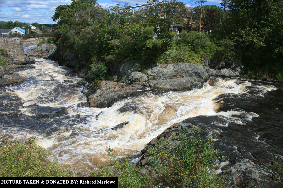
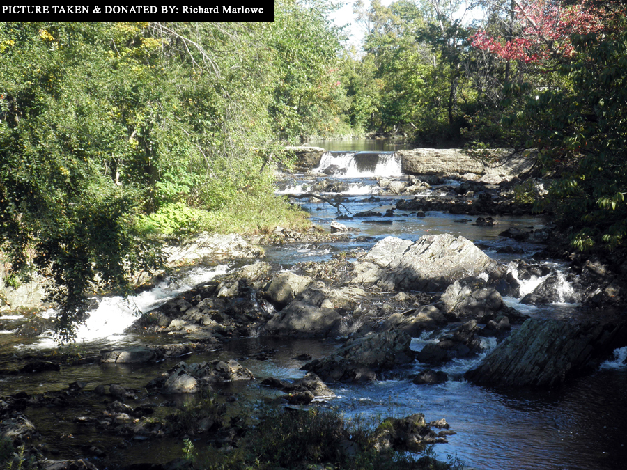
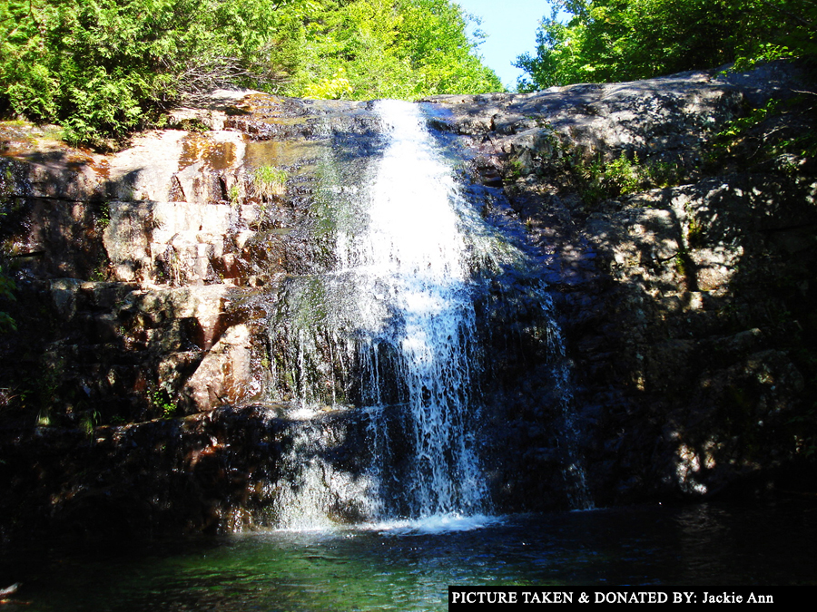
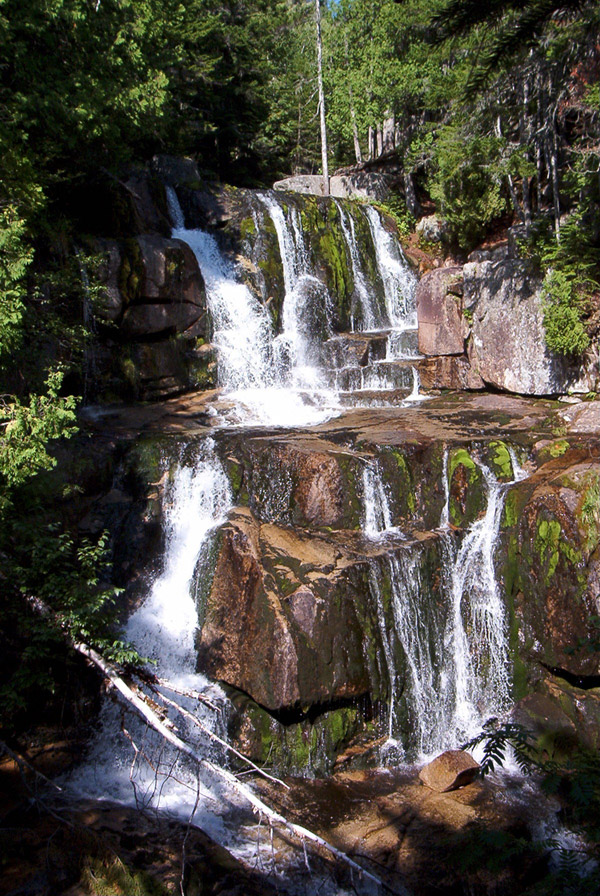