HIKING THE TERRIFYING 25 LIST
Welcome to the Newenglandwaterfalls.com guide to hiking and climbing New Hampshire's Terrifying 25 list!
The Terrifying 25 is one of several extremely fun hiking lists in New England. It is the only list dedicated to climbing the scariest of New Hampshire's trails. The list was created by Alex, Sage & Patricia Herr and it focuses on NH's trails that include rock scrambles, scree slopes, boulder caves, ladders and rock slides.
Of the 25 trails on this list, 20 trails are required and 5 trails are elective from a pool of 14 trails.
All of the rules for hiking the Terrifying 25 can be found on the official website for the list: The Terrifying 25.
After you hike all 25 trails on this list, you can apply for a patch to formally acknowledge your achievement. Information on applying for a patch can be found here.
If your plan is to hike and climb the Terrifying 25, I highly recommend picking up a copy of the latest edition of this long-trusted and excellent guidebook:
AMC's White Mountain Guide (31st edition; 2022). This guidebook offers detailed instructions and maps to all 25 trails on this list.
Follow New England Waterfalls on Facebook! 
REQUIRED TRAILS
To complete the Terrifying 25 list, you have to hike all twenty (20) of these trails:
TRAIL NAME
|
PEAK / MOUNTAIN |
CLASS
RATING |
DESCRIPTION / NOTES |
| BALDFACE CIRCLE TRAIL |
South Baldface |
II |
several class II scramble moves are required on the ledges of South Baldface; fantastic views are obtained on the ledges and also at the summit of South Baldface; I recommend that you continue on and make a 10-mile loop over both Baldface summits (the summit of North Baldface is one of the best summits in New England); don't miss swimming in the cold but beautiful Emerald Pool on the way down; overnight accommodations are available at the Baldface Shelter (this is a lean-to found below South Baldface) |
| CAPS RIDGE TRAIL |
Mt. Jefferson |
II / II+ |
this is a 2.5 mile one-way hike to the top of Mt. Jefferson from Jefferson Notch Road, but it seems much harder than the mileage indicates; the lower "crag" is the steepest and is quite fun for those who like rock scrambling |
| CARTER LEDGE TRAIL |
Middle Sister /
Mt. Chocorua |
II |
several semi-steep ledges en route to the summit of Middle Sister; only one portion really stands out as semi-challenging (but it's very short) |
| CASTLE TRAIL |
Mt. Jefferson |
II+ |
fantastic views with some challenging rock scrambles; do NOT attempt in foul weather |
| CHEMIN DES DAMES |
Mt. Adams |
II+ |
connects King Ravine to Air Line; rough and very steep scrambling is involved |
| FLUME SLIDE TRAIL |
Mt. Flume |
II+ |
this hike requires a long section of (typically wet) slab scrambling; scrambling up this trail allows you to do a day-hike loop over both Mt. Flume and Mt. Liberty (two 4000-footers); I do NOT recommend descending this route |
| GREAT GULF TRAIL |
Mt. Washington |
II/II+ |
this is a wild, long, and difficult route up Mt. Washington that climbs a steep headwall; route-finding may be difficult in spots |
| GREAT GULLY TRAIL |
Mt. Adams |
II |
this trail connects King Ravine Trail to Thunderstorm Junction on the shoulder of Mt. Adams |
| HUNTINGTON RAVINE TRAIL |
Mt. Washington |
III |
this is undeniably the hardest "hiking" trail in New England; only those with previous scrambling experience should attempt this trail; do NOT try to descend this trail; this trail is typically ice free from mid July through late September, but snow, ice and/or hail can occur in any month; do NOT attempt in foul weather or if the temperature dropped below 32 degrees the night before as having ice present on this trail can be extremely dangerous; if you can hike trail this, you can hike any trail on the Terrifying 25 list |
| ICE GULCH PATH |
n/a |
II |
this path offers extended periods of scrambling over wet & slippery rocks; wild and remote |
| KING RAVINE TRAIL |
Mt. Adams |
II+/III |
this trail climbs a steep headwall and is one of the most scenic scrambles in the White Mountains; an optional trip through "the Subway" (another trail on this list) is also very challenging |
| MADISON GULF TRAIL |
Mt. Madison |
II+ |
this trail is one of the steepest and most challenging hikes in New England; this is arguably the toughest route up Mt. Madison |
| MOUNT MORGAN TRAIL (Ladder Route) |
Mt. Morgan |
II |
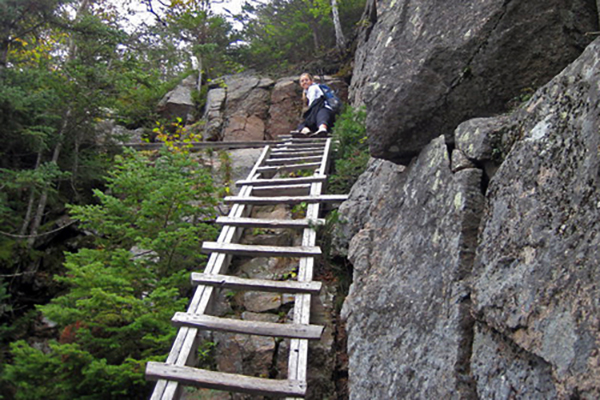
this fun trail involves climbing over several ledges, passing through a boulder cave, and scrambling up three ladders and some ledges; Mt. Morgan is typically combined with Mt. Percival for a classic 5.4-mile loop; don't miss the boulder caves on Mt. Percival; this is a fun family-friendly adventure so long as nobody has a fear of heights |
| MOUNT PERCIVAL TRAIL (Boulder Cave Route) |
Mt. Percival |
II |
this trail includes scrambling through a small boulder cave; this trail is typically combined with Mt. Morgan for classic 5.4 mile loop; it can be tough to find the boulder cave loop from the summit as there is no sign near the summit |
| NORTH SLIDE |
North Tripyramid |
II+/III |
this extremely steep and challenging trail includes lengthy sections of extremely steep slab scrambling; this trail gains 1,200 feet in 0.5 mile, making it one of the steepest trails in New England; do not attempt this trail when wet or icy, and do not use this trail for descent; most hikers will make their hike a loop by descending down the nearby South Slide. |
| SIX HUSBANDS TRAIL |
Mt. Jefferson |
II |
this trail climbs several steep ladders and ascends towards Mt. Jefferson via some moderately challenging scrambling |
| SOUTH SLIDE |
South Tripyramid |
II |
this slide is full of loose rock scree, but is less steep than the North Slide; however, most hikers will find this sort of loose terrain unpleasant |
| SPHINX TRAIL |
Mt. Clay /
Mt. Jefferson |
unknown |
this steep and tough trail connects the Great Gulf Trail to the Gulfside Trail between Mt. Clay and Mt. Jefferson |
| SUBWAY (King Ravine Trail) |
Mt. Adams |
II/II+ |
this trail includes tough scrambling through some of the most challenging boulder caves in New England |
| TABLE ROCK CLIMBING TRAIL |
Table Rock |
II/II+ |
this trail offers great views of Dixville Notch from the rocky perch at the top; only brave souls will walk across the narrow rock feature to its end; there are three trails up to the beginning of Table Rock - one is extremely steep (the Table Rock Climbing Trail), one is moderate steep, and the easiest approach is via the Cohos Trail from Huntington Cascades |
ELECTIVE TRAILS
To complete the whole Terrifying 25 list, you have to select and hike at least five (5) of these trails:
TRAIL NAME
|
PEAK / MOUNTAIN |
CLASS
RATING |
DESCRIPTION / NOTES |
| AIR LINE TRAIL |
Mt. Adams |
II |
this is one of several exciting routes to the summit of Mt. Adams; many other less-scrambly trail options are available for the return trip back down |
| ALGONQUIN TRAIL |
Sandwich Dome |
unknown |
this is a rough, steep and remote trail; getting to the trailhead typically requires at least a moderate-clearance vehicle |
| BEAVER BROOK TRAIL |
Mt. Moosilauke |
II |
this steep trail climbs alongside several series of picturesque waterfalls; some wooden blocks are bolted to rocks to assist you in the steepest sections; this trail will ultimately bring you to the awesome bare summit of Mt. Moosilauke; a lean-to shelter is available en route for those that want an overnight adventure |
| BROOK TRAIL |
Mt. Chocorua |
II |
several short and fun sections of scrambling are found on the south slopes of Chocorua (which is one of the most rewarding 3000-footers in New England); this is the steepst trail on Chocorua |
| BLUEBERRY LEDGE TRAIL |
Mt. Whiteface |
II |
only one or two short sections of this trail are steep and challenging; the rest of the trail is much less steep; beautiful views from the ledges below the actual ("true") summit of Mt. Whiteface; you can continue across the ridge and make a loop over the summit of Mt. Passaconaway (make sure to take the 0.3 mile spur trail downhill to the north for the best views on Passaconaway) |
| CASTLE RAVINE TRAIL |
Mt. Jefferson |
II |
involves scrambling and a significant amount of walking on loose talus; a quiet & scenic trail |
| DESOLATION TRAIL |
Mt. Carrigain |
I+/II |
a rough trail with sections of moderate rock scrambling |
| DEVIL'S HOPYARD |
n/a |
I+/II |
this trail climbs over and around wet & slippery boulders |
| GOODRICH ROCK TRAIL |
n/a |
I+ |
this trail climbs a near-vertical, 20-foot tall ladder; no rock scrambling involved |
| HI-CANNON TRAIL |
Cannon Mountain |
I+ |
this trail has one fun and challenging wooden ladder to climb, plus some moderate hand-scrambling; I recommend returning via Lonesome Lake for a nice day-hike loop |
| OSSEO TRAIL |
Mt. Flume |
I+ |
this trail climbs several steep-angle wooden ladders; no rock scrambling involved |
| PERCY PEAKS TRAIL |
North Percy Peak |
II |
this trail offers fun scrambling on a remote peak; access is via the remote Nash Stream Road in the northern region of the White Mountain National Forest |
WILDCAT RIDGE TRAIL
(western section) |
Wildcat, Peak E |
II |
the steepness of this trail begins very close to the Glen Ellis Falls trailhead; good views are obtained very quickly on this climb, and several wooden blocks assist you in the trickiest spots; if the river-crossing at the start is running high, you can cross upstream at the AMC Pinkham Notch Center |
WILLEY RANGE TRAIL
(southern section) |
Mt. Willey |
I+ |
this trail climbs several near-vertical wooden ladders; little or no rock scrambling involved |
Although you can't really go wrong with selecting any of the above elective trails to complete the Terrifying 25 list, I recommend doing these five:
- Air Line Trail
- Beaver Brook Trail
- Blueberry Ledge Trail
- Castle Ravine Trail
- Percy Peaks Trail
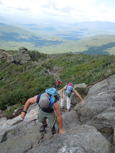
Caps Ridge Trail, Mt. Jefferson
TIPS FOR HIKING THE TERRIFYING 25
- BUG SEASON - Unless you are a masochist, avoid hiking the Terrifying 25 in New Hampshire from late-May through early July. This is black fly season and they can be absolutely intolerable (think Alaskan mosquito-bad). You can try to use bug spray or DEET-based products, but they don't always work well for all people. If you absolutely must hike during this time-frame, do yourself a favor and consider getting a wide-brimmed hat and a mesh bug net.
- TRAIL CONDITIONS - Review Trailsnh.com to obtain the latest in trail conditions (especially in winter and early spring, when snow & ice conditions can be highly variable).
- READ GUIDEBOOKS - Buy the revelent hiking guidebooks and actually read each relevant chapter before you take your hiking trip. You'll understand potential dangers and also make sure you don't miss any scenic views or other interesting diversions along the way.
- CONSIDER LEAVING YOUR TREKKING POLES AT HOME - I normally love trekking poles, but I prefer not to have them in my hands or stored on my pack while I am rock scrambling on the 52 WAV trails.
- LEAVE A NOTE - Always leave a note or tell someone which trails and mountains you will be hiking (too many people get lost and/or injured in the mountains of New Hampshire).
- BEWARE OF BREAK-INS - Don't leave anything valuable in your car (unfortunately, too many break-ins have occurred in New Hampshire).
- GET CREATIVE - Learn the value of hitch-hiking, using a car-spot, and/or mountain biking between trailheads (note: a traverse is almost always more interesting than an out-and-back hike).
- START HIKING EARLY - Start your hikes early (i.e. before 7:30am) to beat most of the crowds on the popular trails.
- HIKE IN SEPTEMBER - Mid-week September hiking is amazing. Hike at least once during this time-frame (call out sick from work if you have to).
- VISIT THE MOUNTAIN WANDERER - Introduce yourself to Steve Smith at the Mountain Wanderer in Lincoln at some point (there aren't many people as passionate about New Hampshire's trails as he is).
- GET AN REI MEMBERSHIP - Purchase a $20 REI membership to save 8-10% on all full-price REI purchases for the rest of your life (you have no idea how much time you'll probably spend at their stores and on rei.com). Also, strongly consider applying for the REI credit card (you can earn hundreds of dollars in dividends each year if you use this credit card as your primary card for your non-REI purchases).
- BLUEBIRD DAYS - Do the great mountains on the bluebird days, and the less interesting mountains on the overcast or lousy-weather days.
- PEAK FOLIAGE - Don't miss hiking some of the Terrifying 25 during peak fall foliage in early October.
- GET SOME ELECTROLYTES - Bring some Gatorade (or something similar) to get some electrolytes into your system. This is especially important on hot and humid days. Rock scrambling is exhausting, and this will help you power through it.
- VITAMIN I - Ibuprofen can be extremely helpful tool in controlling pain and/or reducing swelling, especially on tough hikes.
- ADVERSE WEATHER - New Hampshire's mountains can be nasty (even deadly) in adverse weather conditions. Snow and ice can also be very problematic on most of the 52 WAV trails. The trails are often covered in snow and ice from early October and often extending well into May.
- MEETUP.COM - If you are short on hiking partners, consider joining a Meetup hiking group (there are several groups and they always have good hikes planned) or ask for partners on a Facebook hiking 'group'. However, don't even sign up for a trail that is beyond your abilities.
- WILDERNESS FIRST AID - Take a wilderness first aid course to prepare you in case something goes wrong. Something is more likely to go wrong on tougher trails like those found on the Terrifying 25 list.
- BRING A REAL CAMERA - Don't forget your camera, and remember to label the pictures after you are done with each hike (you'll want to capture these moments). I recommend that you bring a real point-and-shoot or DSLR camera instead of taking pictures with your smart-phone. The reason is because the camera resolution on your smart-phone will not look good on tablet and computer monitors 10 or 20 years from now. Photos from smart-phones generally don't print or enlarge very well, either.
- AMC WHITE MOUNTAIN GUIDE - The AMC White Mountain Guide (31st edition; 2022) literally describes every single trail in the White Mountains. There are no pictures in this guidebook, but it's the finest and most accurate hiking guidebook on the planet. In fact, it's widely known as the 'Hikers Bible'.
- ROAD STATUS - Keep abreast as to which roads in the White Mountain National Forest roads are currently closed. The rangers maintain a road status log here (although it is not always updated timely).
- AVOID DESCENDING THESE TRAILS - It is unwise to try to descend many of the trails listed on the Terrifying 25 list.
- WINTER HIKING ON THE TERRIFYING 25 - Winter hiking on the Terrifying 25 trails can be extremely challenging and potentially dangerous. An ice ax and crampons are often required. Some trails require a Herculean effort to climb in winter (like the Great Gulf Trail).
- CLIMBING HUNTINGTON RAVINE - The Huntington Ravine Trail on Mt. Washington is the most challenging climb on this list, and it should absolutely be avoided when wet or icy. Many hikers will find the exposure on this trail uncomfortable. One suggestion I have is to use rock climbing shoes on the steep slabs.
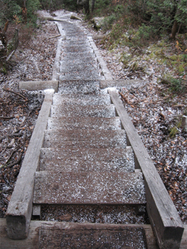
Osseo Trail, Mt. Flume
MORE GREAT ROCK SCRAMBLES IN NEW ENGLAND
There are many other great rock scrambles in New England. Here is a list of the best:
- CONNECTICUT
- Appalachian Trail on Bear Mountain
- Blue/Quinnipiac Trail
- MAINE
- Appalachian Trail on Bemis Mountain
- Abol Slide, Katahdin, Baxter State Park
- Beehive Trail, Acadia National Park
- Cathedral Trail, Katahdin, Baxter State Park
- Dudley Trail, Katahdin, Baxter State Park (closed for at least 2016 and 2017)
- Hunt Trail, Katahdin, Baxter State Park
- Knife Edge Trail, Katahdin, Baxter State Park
- RAM Trail, Little Spencer Mountain
- Loop Trail, Tumbledown Mountain
- Mahoosuc Notch
- Mount Coe Trail
- Precipice Trail, Acadia National Park
- West Face Trail, Cadillac Mountain, Acadia National Park
- NEW HAMPSHIRE
- Adams Slide Trail, Mt. Adams (this is an abandoned trail)
- Arrow Slide, South Hancock (this is an abandoned trail)
- Holt Trail, Mt. Cardigan (one section is class III)
- Main Trail, Mt. Major
- Mount Osceola Trail, between Osceola and East Osceola
- Owl's Head Path, Owl's Head
- Spellman Trail, Mt. Monadnock
- Star Lake Trail, Mt. Adams
- Underhill Trail, North Percy Peak (this is an abandoned trail)
- White Dot Trail, Mt. Monadnock
- VERMONT
- Cliff Trail, Mt. Mansfield
- Hell Brook Trail, Mt. Mansfield
- Long Trail, Camel's Hump
- The Subway, Mt. Mansfield
If you know of any other rock scrambles that should be included in the above list, please email me @ gparsons66@hotmail.com so that I can consider adding them.
My online guide to all known rock-scrambling trails in New England can be found here.
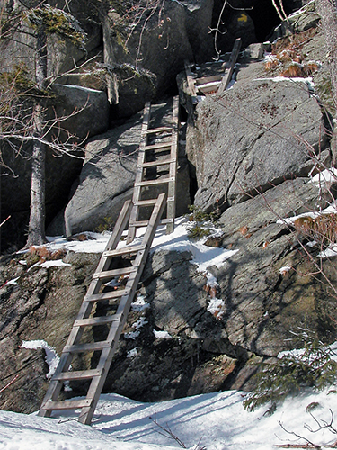
the three ladders found on the Mount Morgan Trail
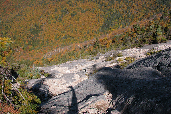
the extremely steep class III North Slide, North Tripyramid
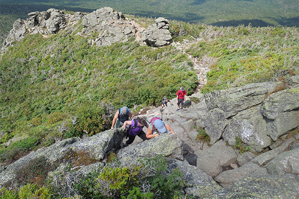
Caps Ridge Trail, Mt. Jefferson
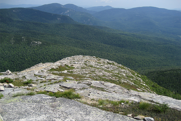
view above the ledges on South Baldface
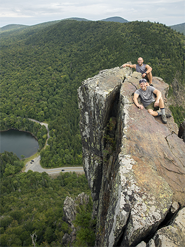
the steep and scary end of Table Rock in Dixville Notch
HELPFUL LINKS
Here are some helpful links covering the Terrifying 25 list:
- Official rules for hiking the Terrifying 25 = link
- Rock scrambling in New England = link
|


